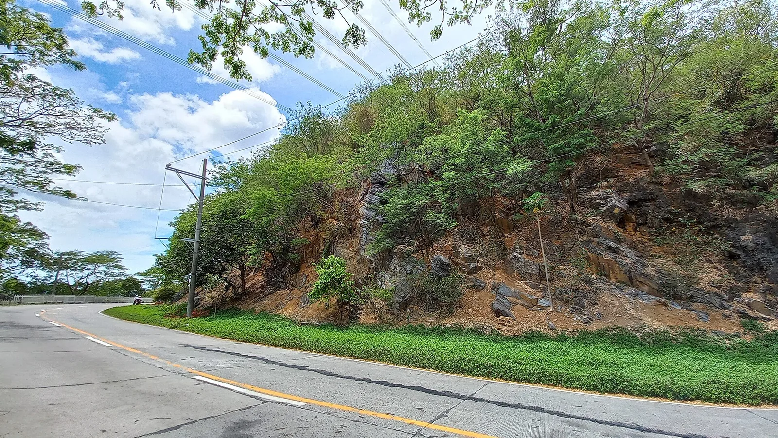
Masungi Georeserve sits in the rain-soaked hills of Tanay, Rizal, roughly 47 kilometres east of Metro Manila. It is not a national park in the strict sense. It is a privately led conservation area that protects a 1,600-hectare karst landscape from quarrying and illegal logging. What visitors actually walk through is a fraction of that: a carefully built trail that threads between jagged limestone peaks, across hanging bridges, and down into a cool cave that cuts straight through one of the rock formations.
Masungi Georeserve: The Rock Trail and Cave Through a Karst Forest
Trip.com
Search on Trip.comHotels in Manila
Compare live prices via Travelpayouts — targeted for this guide.
The experience is split into two main routes. The Discovery Trail is the original, shorter loop. The Rock Trail and Cave is the deeper, longer route that takes you further into the karst forest, through Sapot and Patak, down into the cave, and up to the peak called Liwasan. This guide focuses on the Rock Trail and Cave, which is the route most active travellers ask us about.
What the Rock Trail and Cave Actually Is
The Rock Trail and Cave is a roughly 4 to 5 kilometre guided loop that takes between three and five hours depending on your pace and how long you stop at each feature. Unlike a typical mountain hike, the trail here is engineered. There are rope bridges, catwalks bolted into limestone, and staircases that cling to vertical rock faces. The point is not to conquer a summit. The point is to move through a landscape that would otherwise be impossible to access without damaging it.
The cave portion is the centerpiece. After crossing a series of bridges and climbing through the bonsai-like vegetation that clings to the karst, the trail drops into a natural opening in the limestone. Inside, the temperature drops noticeably. The cave is short, maybe 60 metres through, but it is dark, wet in places, and requires you to crouch and scramble. You exit on the other side of the formation into a different section of forest. It is not a technical caving experience, but it is not a walk in a park either.
Trip.com
See all tours in Manila on Trip.comHiking tour in Manila
Hand-picked experiences in Manila — book on Trip.com with instant confirmation.
How to Get to Masungi Georeserve From Manila
From Metro Manila, the drive to Masungi takes about 1.5 to 2 hours via Marcos Highway through Antipolo and into Tanay. If you are taking public transport, there are vans from Shaw Boulevard in Mandaluyong that go to Tanay town proper. From Tanay, you will need a tricycle or a pre-arranged pickup to reach the georeserve entrance, which is along the highway but set back from the road.
Most visitors hire a private car or join an organised tour. Parking is limited and the entrance is gated, so you cannot simply show up. You must have a confirmed booking before arriving. Walk-ins are not accepted.
Booking, Schedule, and 2026 Pricing
As of 2026, the Rock Trail and Cave is priced at PHP 2,500 per person for the weekday rate and PHP 2,800 per person on weekends. This includes the guided trail, a light snack, and the conservation fee. The Discovery Trail is slightly cheaper at PHP 1,900 weekday and PHP 2,200 weekend, but it does not include the cave section.
Bookings are done through the official Masungi Georeserve website. Slots are released in batches and tend to sell out weeks in advance, especially for weekend dates and the cooler months from November to February. You will receive a confirmation email with your trail assignment, meeting time, and what to bring.
Trail sessions run twice a day, usually a morning slot around 8:00 AM and a midday slot around 11:00 AM. The morning slot is better for photography and for avoiding the heat that builds up on the exposed rock sections by early afternoon.
What to Wear and Bring
The trail is physical. You will be climbing, crouching, and walking on uneven rock. Wear closed-toe shoes with grip. Running shoes work, but trail shoes are better. Do not wear sandals or flip-flops; you will be turned away at the briefing area.
Clothing should be light and quick-drying. The cave section will get you muddy, and the forest sections can be humid even in the dry season. Bring at least one litre of water, though the guides carry extra. A small dry bag for your phone is useful because the cave has water dripping from the ceiling. Insect repellent is recommended, especially during the wetter months.
Gloves are provided at the site for the rope and cable sections. You do not need to bring your own.
The Trail Features in Order
After the briefing at the visitor center, the trail begins with a descent into the forest. The first major feature is Sapot, a web-like platform suspended across a limestone crevice. From there you cross a hanging bridge to Patak, a circular platform built around a tree. Both are popular photo stops, but the guides keep the group moving.
The trail then climbs through denser forest toward the cave entrance. The vegetation here is genuinely interesting: the karst supports a stunted, bonsai-like forest with pitcher plants and orchids growing directly out of rock cracks. If you are into botany, this section alone is worth the trip.
The cave is entered in single file. There is no artificial lighting inside. You use the headlamp provided. The passage is narrow in places and you will need to duck under low ceilings. The floor is a mix of packed earth and smooth rock, with shallow water in the deeper section. After exiting the cave, the trail climbs to Liwasan, a flat rock platform with a view across the karst peaks and, on a clear day, all the way to Laguna de Bay.
The descent from Liwasan is the most physically demanding part. It involves a series of staircases and a final rope-assisted section before you return to the visitor center for the snack and debrief.
Is the Trail Safe?
The trail is built to a high standard and the guides are trained, but it is not risk-free. The rock surfaces are slippery when wet, and the cave section involves scrambling in low light. The operators enforce a strict no-phones-while-walking policy on the bridges and cable sections. If you want photos, you stop, secure yourself, and then shoot.
There is a weight and age limit. The trail is generally open to ages 13 and up, and the operators may decline participation for guests with mobility issues or certain medical conditions. If you have any doubt, contact them before booking.
When to Go
The best months are November to March, when the weather is cooler and the trail is dry. April and May are hot, and the exposed rock sections become uncomfortable by midday. The rainy season from June to October is manageable but the cave and bridges become slippery, and some slots may be cancelled if a storm is approaching.
If you want the best light for photography, book the morning slot. The sun hits the karst peaks from the east, which gives you warm side-lighting on Sapot and Liwasan.
Why Masungi Matters Beyond the Trail
What makes Masungi worth supporting is not just the engineering of the trail. It is the fact that this land was actively being quarried before the conservation project began. The limestone hills of Tanay are a target for extractive industries, and the georeserve is essentially a fence around a surviving patch of forest. The trail fee funds the rangers, the reforestation work, and the legal fight to keep the boundary intact.
When you pay PHP 2,500 for the Rock Trail, part of that money goes to planting native trees in the degraded zones and paying forest rangers who patrol against illegal cutting. This is not greenwashing. The area you walk through was literally being destroyed a decade ago.
Plan Your Trip With PANA
Ready to walk the karst forest of Tanay? Build your full Luzon itinerary with our destination guides, book a guided transfer through our tours directory, find a place to stay in Rizal through our hotel listings, and read more field notes on our blog.
Frequently Asked Questions
Can I do the Rock Trail and Cave without prior hiking experience?
Yes, but you should be reasonably fit. The trail involves climbing, scrambling, and walking on uneven rock for several hours. If you can walk up five flights of stairs without stopping, you can probably finish it.
Is the cave section claustrophobic?
It is tight in places but not extreme. The passage is roughly 60 metres and you will need to crouch for parts of it. If you have severe claustrophobia, you can ask the guide about skipping the cave and rejoining the group on the other side.
Are children allowed on the Rock Trail and Cave?
The trail is generally open to ages 13 and up. The Discovery Trail has a lower age threshold. Check the current policy at booking because the operators adjust limits based on trail conditions.
Can I bring a DSLR camera?
Yes, but you carry it at your own risk. The cave section and the bridges are rough on gear. A compact camera or a phone in a dry bag is more practical.
What happens if it rains during my slot?
Light rain is fine and the trail continues. Heavy rain or an approaching storm may cause the operators to cancel or shorten the trail. In that case, you are typically offered a reschedule.
Sources and References
Sources
Primary references for the figures and rules in this guide. Fees and schedules change — check the source before you travel.

PANA.PH Luzon Desk
Luzon travel logistics — Manila, Baguio and North Luzon
The Luzon Desk of the PANA.PH travel desk: it maintains and re-checks the luzon travel logistics — manila, baguio and north luzon data behind the site's guides — operator price lists, official fee schedules and posted timetables — and publishes what it can verify.
🏡 Real local stays (book direct)
Hand-picked homestays and guesthouses — book direct, no markup.
Browse all local stays →
🌊 Popular activities (book instantly)
Island hopping, canyoneering, whale sharks — real Klook/GetYourGuide options.
View all activities →