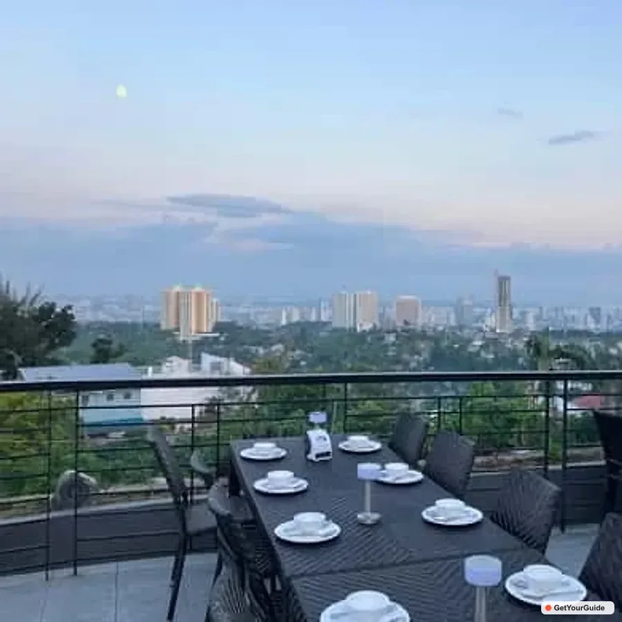
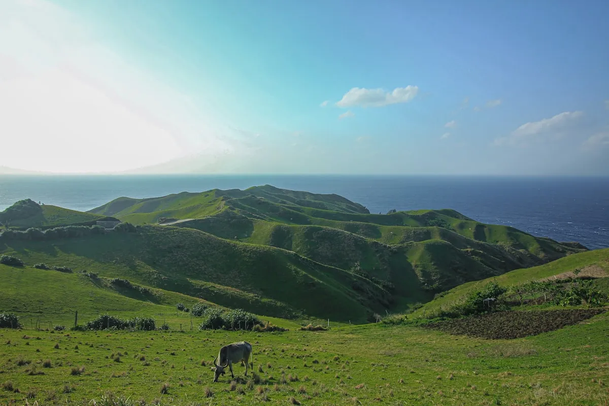
Mount Apo rises to 2,954 meters above sea level, making it the highest point in the Philippines. It sits on the border of Davao del Sur and North Cotabato, surrounded by a national park that protects mossy forests, sulfur vents, crater lakes, and rare Philippine eagles. Climbing Mount Apo is not a casual day hike. It is a multi-day trek that requires permits, guides, and proper preparation. For many Filipino hikers and international visitors, standing on the summit is a serious mountaineering goal that rewards effort with sweeping views of Davao City, Sarangani Bay, and the Central Mindanao highlands.
Mount Apo: Climbing the Highest Mountain in the Philippines
Trip.com
Search on Trip.comHotels in Philippines
Compare live prices via Travelpayouts — targeted for this guide.
Why climb Mount Apo
The mountain is a volcano, though it has not erupted in recorded history. The last known activity produced fumaroles and hot springs that hikers can still smell near the crater. The trek passes through multiple ecosystems in a short distance. You start in grassland and agricultural clearings, enter thick montane forest full of roots and ferns, break into mossy forest where everything is draped in green, and finish above the tree line on a rocky summit. The contrast is one of the reasons the mountain is included on the tentative list of UNESCO World Heritage Sites.
Beyond the landscape, the climb is a mental challenge. The summit push is steep, and the cold wind above 2,500 meters can be surprising for anyone used to tropical heat. Hikers return with stronger legs, clearer photos, and a certificate that proves they stood at the top of the country. For the 2026 season, the mountain is open to organized climbs through several recognized trail systems, though permit limits keep the trails from being overwhelmed.
The main trails to the summit
There are two main jump-off points that most climbers use. The Kidapawan Trail in North Cotabato is the most popular. It is a three-day, two-night route that starts in Barangay Ilomavis and passes through forests, river crossings, and boulder fields. The Kapatagan Trail in Davao del Sur is a longer approach that many groups use for a four-day, three-night itinerary. It is considered more scenic and less crowded, but it requires better stamina and more supplies.
Trip.com
See all tours in Philippines on Trip.comHiking tour in Philippines
Hand-picked experiences in Philippines — book on Trip.com with instant confirmation.
Lesser-known trails include the Magpet Trail and the Sibulan Trail. These are used by local hikers and require more coordination with the barangay. For first-time climbers, the Kidapawan Trail is usually recommended because the trail is better established, the water sources are more reliable, and the rescue infrastructure is closer. The Kapatagan Trail is better for those who want solitude and have time to spare.
How the trails compare
- Kidapawan Trail - 3 days / 2 nights, moderate to difficult, best for first-time Apo climbers
- Kapatagan Trail - 4 days / 3 nights, difficult, better for experienced hikers who want fewer crowds
- Magpet Trail - 3 to 4 days, remote, requires local coordination
- Sibulan Trail - 2 to 3 days, steep, shorter but more technical
Permits and registration
You cannot climb Mount Apo without a permit. The mountain is part of Mount Apo Natural Park, and the Department of Environment and Natural Resources along with local government units manage access. Climbers book through accredited guides or local tourism offices. The permit fee is usually PHP 500 to PHP 1,000 per person, depending on the trail. There is also an environmental fee of PHP 200 to PHP 500 and a barangay registration fee of PHP 50 to PHP 100.
Accredited guides are mandatory. The guide fee ranges from PHP 1,500 to PHP 3,000 per day depending on group size and trail. Porters are optional but strongly recommended because they allow you to conserve energy for the summit. Porter rates are PHP 1,000 to PHP 1,500 per day, plus food. Some guides also cook for the group, while others require you to bring a separate cook or prepare your own meals. Ask your organizer what is included before paying.
Best time to climb in 2026
The climbing season runs from late February to early June. March, April, and May offer the most stable weather and the clearest views. The rainy season from June to October makes trails slippery, river crossings dangerous, and the boulder section near the summit treacherous. December and January can be cold and foggy, though they are sometimes climbable. The mountain is usually closed or heavily restricted during bad weather events.
Full moon and new moon affect summit temperature more than trail conditions. Nights above 2,500 meters can drop to 5 to 10 degrees Celsius, so a good sleeping bag and layered clothing are essential. Windproof gear matters more than rain gear near the top because the summit is exposed and gusty.
How to get to the jump-off
For the Kidapawan Trail, fly to Davao City, then take a bus or van to Kidapawan City. The trip takes two to three hours and costs PHP 150 to PHP 250 by bus or PHP 250 to PHP 400 by van. From Kidapawan, hire a habal-habal or a tricycle to Barangay Ilomavis for PHP 200 to PHP 400. Some organizers include this transfer in the package.
For the Kapatagan Trail, the route is from Davao City to Digos City by bus or van for PHP 100 to PHP 200, then onward to Kapatagan for another PHP 100 to PHP 250. The jump-off in Barangay Kapatagan is higher in elevation, so the first day is less hot but the trail is longer. Many Davao-based operators run door-to-door packages that include transport, guide, porter, food, and tents for PHP 5,000 to PHP 8,000 per person for a group of four or more.
What the climb costs in 2026
A do-it-yourself climb with a local guide, permit, food, and transport starts around PHP 3,500 to PHP 5,000 per person for a group of five. All-inclusive packages from Davao or Kidapawan range from PHP 6,000 to PHP 10,000 per person. These packages cover registration, guide, porter, tent, meals, and round-trip transport. Solo travelers should expect to pay more because guide and porter costs are not split.
Additional costs include bottled water and snacks in town, a sleeping bag rental for PHP 300 to PHP 500, and tips for guides and porters. A reasonable tip is PHP 200 to PHP 500 per guide or porter for a three-day climb. Travel insurance that covers mountain rescue is not included in most local packages and should be purchased separately.
Physical preparation and packing list
Cardio fitness is the single most important preparation. Begin stair climbing, jogging, or cycling at least six weeks before the trek. Leg strength matters because the descent is long and hard on the knees. Practice with a loaded daypack on local trails to get used to the weight of water and food. Hikers who arrive without training often struggle on day two and miss the summit push.
Pack light but bring the right items. A 40 to 50 liter backpack is enough for a three-day climb. Bring two to three liters of water capacity, trail food, a headlamp, rain jacket, warm layers, gloves for the cold summit, sun protection, first aid kit, and a whistle. Trail shoes with good grip are better than running shoes because the boulder section can be sharp. Do not bring cotton clothing because it stays wet and cold. Synthetic or merino layers are worth the cost.
Safety and responsible trekking
Altitude sickness is possible above 2,500 meters, especially for climbers coming from sea level. Symptoms include headache, nausea, and dizziness. The standard advice is to ascend slowly, drink water, and descend if symptoms worsen. Hypothermia is a real risk at night, so keep spare clothes dry in a waterproof bag. The crater area has sulfur vents and unstable ground. Stay on the marked trail and do not camp near the vents.
Leave no trace. Pack out all trash, including food wrappers and toilet paper. Use designated campsites and comfort rooms. Do not pick plants, disturb wildlife, or make loud noise that disturbs other groups. The Philippine eagle and several endemic birds live in the park, so binoculares are useful for birdwatchers who want to spot them.
Sample three-day Kidapawan itinerary
- Day 1 - Travel from Davao to Kidapawan, register, trek to Camp 1 near the river
- Day 2 - Ascend through mossy forest to the summit camp, dinner and early sleep
- Day 3 - Summit at 03:30 for sunrise, descend to jump-off, return to Davao
Frequently Asked Questions
Do I need a guide?
Yes. Climbing without an accredited guide is not allowed and is dangerous. Guides know the trail, manage permits, and carry radios for emergencies. They are also the main source of local employment around the park.
How hard is the climb?
Mount Apo is rated difficult. It is not a technical climb, but the distance, elevation gain, and cold make it demanding. A fit hiker with some multi-day trekking experience can finish it. Beginners should train seriously before attempting the mountain.
Can I climb in one day?
No. The standard itinerary is two to three days depending on the trail. A one-day attempt would be unsafe and is not permitted by local authorities. The park requires overnight camping to manage hiker numbers and rescue capacity.
Is there cellphone signal?
Signal is weak or absent for most of the climb. Some spots near the summit may pick up a signal, but do not rely on it. Inform your family that you will be unreachable for two to four days.
Plan your Mount Apo climb with Pana
Pana works with accredited guides and operators in Davao and North Cotabato to make your climb safe and straightforward. Check our destinations page for Mindanao, compare tours that include Mount Apo packages, and book a hotel in Davao City through our hotels section. For more trail reports and travel guides, read the blog.
Sources and official references
Mount Apo rises to 2,954 meters above sea level, making it the highest point in the Philippines. It sits on the border of Davao del Sur and North Cotabato, surrounded by a national park that protects mossy forests, sulfur vents, crater lakes, and rare Philippine eagles. Climbing Mount Apo is not a casual day hike. It is a multi-day trek that requires permits, guides, and proper preparation. For many Filipino hikers and international visitors, standing on the summit is a serious mountaineering goal that rewards effort with sweeping views of Davao City, Sarangani Bay, and the Central Mindanao highlands.
Why climb Mount Apo
The mountain is a volcano, though it has not erupted in recorded history. The last known activity produced fumaroles and hot springs that hikers can still smell near the crater. The trek passes through multiple ecosystems in a short distance. You start in grassland and agricultural clearings, enter thick montane forest full of roots and ferns, break into mossy forest where everything is draped in green, and finish above the tree line on a rocky summit. The contrast is one of the reasons the mountain is included on the tentative list of UNESCO World Heritage Sites.
Beyond the landscape, the climb is a mental challenge. The summit push is steep, and the cold wind above 2,500 meters can be surprising for anyone used to tropical heat. Hikers return with stronger legs, clearer photos, and a certificate that proves they stood at the top of the country. For the 2026 season, the mountain is open to organized climbs through several recognized trail systems, though permit limits keep the trails from being overwhelmed.
The main trails to the summit
There are two main jump-off points that most climbers use. The Kidapawan Trail in North Cotabato is the most popular. It is a three-day, two-night route that starts in Barangay Ilomavis and passes through forests, river crossings, and boulder fields. The Kapatagan Trail in Davao del Sur is a longer approach that many groups use for a four-day, three-night itinerary. It is considered more scenic and less crowded, but it requires better stamina and more supplies.
Lesser-known trails include the Magpet Trail and the Sibulan Trail. These are used by local hikers and require more coordination with the barangay. For first-time climbers, the Kidapawan Trail is usually recommended because the trail is better established, the water sources are more reliable, and the rescue infrastructure is closer. The Kapatagan Trail is better for those who want solitude and have time to spare.
How the trails compare
- Kidapawan Trail - 3 days / 2 nights, moderate to difficult, best for first-time Apo climbers
- Kapatagan Trail - 4 days / 3 nights, difficult, better for experienced hikers who want fewer crowds
- Magpet Trail - 3 to 4 days, remote, requires local coordination
- Sibulan Trail - 2 to 3 days, steep, shorter but more technical
Permits and registration
You cannot climb Mount Apo without a permit. The mountain is part of Mount Apo Natural Park, and the Department of Environment and Natural Resources along with local government units manage access. Climbers book through accredited guides or local tourism offices. The permit fee is usually PHP 500 to PHP 1,000 per person, depending on the trail. There is also an environmental fee of PHP 200 to PHP 500 and a barangay registration fee of PHP 50 to PHP 100.
Accredited guides are mandatory. The guide fee ranges from PHP 1,500 to PHP 3,000 per day depending on group size and trail. Porters are optional but strongly recommended because they allow you to conserve energy for the summit. Porter rates are PHP 1,000 to PHP 1,500 per day, plus food. Some guides also cook for the group, while others require you to bring a separate cook or prepare your own meals. Ask your organizer what is included before paying.
Best time to climb in 2026
The climbing season runs from late February to early June. March, April, and May offer the most stable weather and the clearest views. The rainy season from June to October makes trails slippery, river crossings dangerous, and the boulder section near the summit treacherous. December and January can be cold and foggy, though they are sometimes climbable. The mountain is usually closed or heavily restricted during bad weather events.
Full moon and new moon affect summit temperature more than trail conditions. Nights above 2,500 meters can drop to 5 to 10 degrees Celsius, so a good sleeping bag and layered clothing are essential. Windproof gear matters more than rain gear near the top because the summit is exposed and gusty.
How to get to the jump-off
For the Kidapawan Trail, fly to Davao City, then take a bus or van to Kidapawan City. The trip takes two to three hours and costs PHP 150 to PHP 250 by bus or PHP 250 to PHP 400 by van. From Kidapawan, hire a habal-habal or a tricycle to Barangay Ilomavis for PHP 200 to PHP 400. Some organizers include this transfer in the package.
For the Kapatagan Trail, the route is from Davao City to Digos City by bus or van for PHP 100 to PHP 200, then onward to Kapatagan for another PHP 100 to PHP 250. The jump-off in Barangay Kapatagan is higher in elevation, so the first day is less hot but the trail is longer. Many Davao-based operators run door-to-door packages that include transport, guide, porter, food, and tents for PHP 5,000 to PHP 8,000 per person for a group of four or more.
What the climb costs in 2026
A do-it-yourself climb with a local guide, permit, food, and transport starts around PHP 3,500 to PHP 5,000 per person for a group of five. All-inclusive packages from Davao or Kidapawan range from PHP 6,000 to PHP 10,000 per person. These packages cover registration, guide, porter, tent, meals, and round-trip transport. Solo travelers should expect to pay more because guide and porter costs are not split.
Additional costs include bottled water and snacks in town, a sleeping bag rental for PHP 300 to PHP 500, and tips for guides and porters. A reasonable tip is PHP 200 to PHP 500 per guide or porter for a three-day climb. Travel insurance that covers mountain rescue is not included in most local packages and should be purchased separately.
Physical preparation and packing list
Cardio fitness is the single most important preparation. Begin stair climbing, jogging, or cycling at least six weeks before the trek. Leg strength matters because the descent is long and hard on the knees. Practice with a loaded daypack on local trails to get used to the weight of water and food. Hikers who arrive without training often struggle on day two and miss the summit push.
Pack light but bring the right items. A 40 to 50 liter backpack is enough for a three-day climb. Bring two to three liters of water capacity, trail food, a headlamp, rain jacket, warm layers, gloves for the cold summit, sun protection, first aid kit, and a whistle. Trail shoes with good grip are better than running shoes because the boulder section can be sharp. Do not bring cotton clothing because it stays wet and cold. Synthetic or merino layers are worth the cost.
Safety and responsible trekking
Altitude sickness is possible above 2,500 meters, especially for climbers coming from sea level. Symptoms include headache, nausea, and dizziness. The standard advice is to ascend slowly, drink water, and descend if symptoms worsen. Hypothermia is a real risk at night, so keep spare clothes dry in a waterproof bag. The crater area has sulfur vents and unstable ground. Stay on the marked trail and do not camp near the vents.
Leave no trace. Pack out all trash, including food wrappers and toilet paper. Use designated campsites and comfort rooms. Do not pick plants, disturb wildlife, or make loud noise that disturbs other groups. The Philippine eagle and several endemic birds live in the park, so binoculares are useful for birdwatchers who want to spot them.
Sample three-day Kidapawan itinerary
- Day 1 - Travel from Davao to Kidapawan, register, trek to Camp 1 near the river
- Day 2 - Ascend through mossy forest to the summit camp, dinner and early sleep
- Day 3 - Summit at 03:30 for sunrise, descend to jump-off, return to Davao
Frequently Asked Questions
Do I need a guide?
Yes. Climbing without an accredited guide is not allowed and is dangerous. Guides know the trail, manage permits, and carry radios for emergencies. They are also the main source of local employment around the park.
How hard is the climb?
Mount Apo is rated difficult. It is not a technical climb, but the distance, elevation gain, and cold make it demanding. A fit hiker with some multi-day trekking experience can finish it. Beginners should train seriously before attempting the mountain.
Can I climb in one day?
No. The standard itinerary is two to three days depending on the trail. A one-day attempt would be unsafe and is not permitted by local authorities. The park requires overnight camping to manage hiker numbers and rescue capacity.
Is there cellphone signal?
Signal is weak or absent for most of the climb. Some spots near the summit may pick up a signal, but do not rely on it. Inform your family that you will be unreachable for two to four days.
Plan your Mount Apo climb with Pana
Pana works with accredited guides and operators in Davao and North Cotabato to make your climb safe and straightforward. Check our destinations page for Mindanao, compare tours that include Mount Apo packages, and book a hotel in Davao City through our hotels section. For more trail reports and travel guides, read the blog.
Sources and official references
Mount Apo rises to 2,954 meters above sea level, making it the highest point in the Philippines. It sits on the border of Davao del Sur and North Cotabato, surrounded by a national park that protects mossy forests, sulfur vents, crater lakes, and rare Philippine eagles. Climbing Mount Apo is not a casual day hike. It is a multi-day trek that requires permits, guides, and proper preparation. For many Filipino hikers and international visitors, standing on the summit is a serious mountaineering goal that rewards effort with sweeping views of Davao City, Sarangani Bay, and the Central Mindanao highlands.
Why climb Mount Apo
The mountain is a volcano, though it has not erupted in recorded history. The last known activity produced fumaroles and hot springs that hikers can still smell near the crater. The trek passes through multiple ecosystems in a short distance. You start in grassland and agricultural clearings, enter thick montane forest full of roots and ferns, break into mossy forest where everything is draped in green, and finish above the tree line on a rocky summit. The contrast is one of the reasons the mountain is included on the tentative list of UNESCO World Heritage Sites.
Beyond the landscape, the climb is a mental challenge. The summit push is steep, and the cold wind above 2,500 meters can be surprising for anyone used to tropical heat. Hikers return with stronger legs, clearer photos, and a certificate that proves they stood at the top of the country. For the 2026 season, the mountain is open to organized climbs through several recognized trail systems, though permit limits keep the trails from being overwhelmed.
The main trails to the summit
There are two main jump-off points that most climbers use. The Kidapawan Trail in North Cotabato is the most popular. It is a three-day, two-night route that starts in Barangay Ilomavis and passes through forests, river crossings, and boulder fields. The Kapatagan Trail in Davao del Sur is a longer approach that many groups use for a four-day, three-night itinerary. It is considered more scenic and less crowded, but it requires better stamina and more supplies.
Lesser-known trails include the Magpet Trail and the Sibulan Trail. These are used by local hikers and require more coordination with the barangay. For first-time climbers, the Kidapawan Trail is usually recommended because the trail is better established, the water sources are more reliable, and the rescue infrastructure is closer. The Kapatagan Trail is better for those who want solitude and have time to spare.
How the trails compare
- Kidapawan Trail - 3 days / 2 nights, moderate to difficult, best for first-time Apo climbers
- Kapatagan Trail - 4 days / 3 nights, difficult, better for experienced hikers who want fewer crowds
- Magpet Trail - 3 to 4 days, remote, requires local coordination
- Sibulan Trail - 2 to 3 days, steep, shorter but more technical
Permits and registration
You cannot climb Mount Apo without a permit. The mountain is part of Mount Apo Natural Park, and the Department of Environment and Natural Resources along with local government units manage access. Climbers book through accredited guides or local tourism offices. The permit fee is usually PHP 500 to PHP 1,000 per person, depending on the trail. There is also an environmental fee of PHP 200 to PHP 500 and a barangay registration fee of PHP 50 to PHP 100.
Accredited guides are mandatory. The guide fee ranges from PHP 1,500 to PHP 3,000 per day depending on group size and trail. Porters are optional but strongly recommended because they allow you to conserve energy for the summit. Porter rates are PHP 1,000 to PHP 1,500 per day, plus food. Some guides also cook for the group, while others require you to bring a separate cook or prepare your own meals. Ask your organizer what is included before paying.
Best time to climb in 2026
The climbing season runs from late February to early June. March, April, and May offer the most stable weather and the clearest views. The rainy season from June to October makes trails slippery, river crossings dangerous, and the boulder section near the summit treacherous. December and January can be cold and foggy, though they are sometimes climbable. The mountain is usually closed or heavily restricted during bad weather events.
Full moon and new moon affect summit temperature more than trail conditions. Nights above 2,500 meters can drop to 5 to 10 degrees Celsius, so a good sleeping bag and layered clothing are essential. Windproof gear matters more than rain gear near the top because the summit is exposed and gusty.
How to get to the jump-off
For the Kidapawan Trail, fly to Davao City, then take a bus or van to Kidapawan City. The trip takes two to three hours and costs PHP 150 to PHP 250 by bus or PHP 250 to PHP 400 by van. From Kidapawan, hire a habal-habal or a tricycle to Barangay Ilomavis for PHP 200 to PHP 400. Some organizers include this transfer in the package.
For the Kapatagan Trail, the route is from Davao City to Digos City by bus or van for PHP 100 to PHP 200, then onward to Kapatagan for another PHP 100 to PHP 250. The jump-off in Barangay Kapatagan is higher in elevation, so the first day is less hot but the trail is longer. Many Davao-based operators run door-to-door packages that include transport, guide, porter, food, and tents for PHP 5,000 to PHP 8,000 per person for a group of four or more.
What the climb costs in 2026
A do-it-yourself climb with a local guide, permit, food, and transport starts around PHP 3,500 to PHP 5,000 per person for a group of five. All-inclusive packages from Davao or Kidapawan range from PHP 6,000 to PHP 10,000 per person. These packages cover registration, guide, porter, tent, meals, and round-trip transport. Solo travelers should expect to pay more because guide and porter costs are not split.
Additional costs include bottled water and snacks in town, a sleeping bag rental for PHP 300 to PHP 500, and tips for guides and porters. A reasonable tip is PHP 200 to PHP 500 per guide or porter for a three-day climb. Travel insurance that covers mountain rescue is not included in most local packages and should be purchased separately.
Physical preparation and packing list
Cardio fitness is the single most important preparation. Begin stair climbing, jogging, or cycling at least six weeks before the trek. Leg strength matters because the descent is long and hard on the knees. Practice with a loaded daypack on local trails to get used to the weight of water and food. Hikers who arrive without training often struggle on day two and miss the summit push.
Pack light but bring the right items. A 40 to 50 liter backpack is enough for a three-day climb. Bring two to three liters of water capacity, trail food, a headlamp, rain jacket, warm layers, gloves for the cold summit, sun protection, first aid kit, and a whistle. Trail shoes with good grip are better than running shoes because the boulder section can be sharp. Do not bring cotton clothing because it stays wet and cold. Synthetic or merino layers are worth the cost.
Safety and responsible trekking
Altitude sickness is possible above 2,500 meters, especially for climbers coming from sea level. Symptoms include headache, nausea, and dizziness. The standard advice is to ascend slowly, drink water, and descend if symptoms worsen. Hypothermia is a real risk at night, so keep spare clothes dry in a waterproof bag. The crater area has sulfur vents and unstable ground. Stay on the marked trail and do not camp near the vents.
Leave no trace. Pack out all trash, including food wrappers and toilet paper. Use designated campsites and comfort rooms. Do not pick plants, disturb wildlife, or make loud noise that disturbs other groups. The Philippine eagle and several endemic birds live in the park, so binoculares are useful for birdwatchers who want to spot them.
Sample three-day Kidapawan itinerary
- Day 1 - Travel from Davao to Kidapawan, register, trek to Camp 1 near the river
- Day 2 - Ascend through mossy forest to the summit camp, dinner and early sleep
- Day 3 - Summit at 03:30 for sunrise, descend to jump-off, return to Davao
Frequently Asked Questions
Do I need a guide?
Yes. Climbing without an accredited guide is not allowed and is dangerous. Guides know the trail, manage permits, and carry radios for emergencies. They are also the main source of local employment around the park.
How hard is the climb?
Mount Apo is rated difficult. It is not a technical climb, but the distance, elevation gain, and cold make it demanding. A fit hiker with some multi-day trekking experience can finish it. Beginners should train seriously before attempting the mountain.
Can I climb in one day?
No. The standard itinerary is two to three days depending on the trail. A one-day attempt would be unsafe and is not permitted by local authorities. The park requires overnight camping to manage hiker numbers and rescue capacity.
Is there cellphone signal?
Signal is weak or absent for most of the climb. Some spots near the summit may pick up a signal, but do not rely on it. Inform your family that you will be unreachable for two to four days.
Plan your Mount Apo climb with Pana
Pana works with accredited guides and operators in Davao and North Cotabato to make your climb safe and straightforward. Check our destinations page for Mindanao, compare tours that include Mount Apo packages, and book a hotel in Davao City through our hotels section. For more trail reports and travel guides, read the blog.
Sources and official references
Mount Apo rises to 2,954 meters above sea level, making it the highest point in the Philippines. It sits on the border of Davao del Sur and North Cotabato, surrounded by a national park that protects mossy forests, sulfur vents, crater lakes, and rare Philippine eagles. Climbing Mount Apo is not a casual day hike. It is a multi-day trek that requires permits, guides, and proper preparation. For many Filipino hikers and international visitors, standing on the summit is a serious mountaineering goal that rewards effort with sweeping views of Davao City, Sarangani Bay, and the Central Mindanao highlands.
Why climb Mount Apo
The mountain is a volcano, though it has not erupted in recorded history. The last known activity produced fumaroles and hot springs that hikers can still smell near the crater. The trek passes through multiple ecosystems in a short distance. You start in grassland and agricultural clearings, enter thick montane forest full of roots and ferns, break into mossy forest where everything is draped in green, and finish above the tree line on a rocky summit. The contrast is one of the reasons the mountain is included on the tentative list of UNESCO World Heritage Sites.
Beyond the landscape, the climb is a mental challenge. The summit push is steep, and the cold wind above 2,500 meters can be surprising for anyone used to tropical heat. Hikers return with stronger legs, clearer photos, and a certificate that proves they stood at the top of the country. For the 2026 season, the mountain is open to organized climbs through several recognized trail systems, though permit limits keep the trails from being overwhelmed.
The main trails to the summit
There are two main jump-off points that most climbers use. The Kidapawan Trail in North Cotabato is the most popular. It is a three-day, two-night route that starts in Barangay Ilomavis and passes through forests, river crossings, and boulder fields. The Kapatagan Trail in Davao del Sur is a longer approach that many groups use for a four-day, three-night itinerary. It is considered more scenic and less crowded, but it requires better stamina and more supplies.
Lesser-known trails include the Magpet Trail and the Sibulan Trail. These are used by local hikers and require more coordination with the barangay. For first-time climbers, the Kidapawan Trail is usually recommended because the trail is better established, the water sources are more reliable, and the rescue infrastructure is closer. The Kapatagan Trail is better for those who want solitude and have time to spare.
How the trails compare
- Kidapawan Trail - 3 days / 2 nights, moderate to difficult, best for first-time Apo climbers
- Kapatagan Trail - 4 days / 3 nights, difficult, better for experienced hikers who want fewer crowds
- Magpet Trail - 3 to 4 days, remote, requires local coordination
- Sibulan Trail - 2 to 3 days, steep, shorter but more technical
Permits and registration
You cannot climb Mount Apo without a permit. The mountain is part of Mount Apo Natural Park, and the Department of Environment and Natural Resources along with local government units manage access. Climbers book through accredited guides or local tourism offices. The permit fee is usually PHP 500 to PHP 1,000 per person, depending on the trail. There is also an environmental fee of PHP 200 to PHP 500 and a barangay registration fee of PHP 50 to PHP 100.
Accredited guides are mandatory. The guide fee ranges from PHP 1,500 to PHP 3,000 per day depending on group size and trail. Porters are optional but strongly recommended because they allow you to conserve energy for the summit. Porter rates are PHP 1,000 to PHP 1,500 per day, plus food. Some guides also cook for the group, while others require you to bring a separate cook or prepare your own meals. Ask your organizer what is included before paying.
Best time to climb in 2026
The climbing season runs from late February to early June. March, April, and May offer the most stable weather and the clearest views. The rainy season from June to October makes trails slippery, river crossings dangerous, and the boulder section near the summit treacherous. December and January can be cold and foggy, though they are sometimes climbable. The mountain is usually closed or heavily restricted during bad weather events.
Full moon and new moon affect summit temperature more than trail conditions. Nights above 2,500 meters can drop to 5 to 10 degrees Celsius, so a good sleeping bag and layered clothing are essential. Windproof gear matters more than rain gear near the top because the summit is exposed and gusty.
How to get to the jump-off
For the Kidapawan Trail, fly to Davao City, then take a bus or van to Kidapawan City. The trip takes two to three hours and costs PHP 150 to PHP 250 by bus or PHP 250 to PHP 400 by van. From Kidapawan, hire a habal-habal or a tricycle to Barangay Ilomavis for PHP 200 to PHP 400. Some organizers include this transfer in the package.
For the Kapatagan Trail, the route is from Davao City to Digos City by bus or van for PHP 100 to PHP 200, then onward to Kapatagan for another PHP 100 to PHP 250. The jump-off in Barangay Kapatagan is higher in elevation, so the first day is less hot but the trail is longer. Many Davao-based operators run door-to-door packages that include transport, guide, porter, food, and tents for PHP 5,000 to PHP 8,000 per person for a group of four or more.
What the climb costs in 2026
A do-it-yourself climb with a local guide, permit, food, and transport starts around PHP 3,500 to PHP 5,000 per person for a group of five. All-inclusive packages from Davao or Kidapawan range from PHP 6,000 to PHP 10,000 per person. These packages cover registration, guide, porter, tent, meals, and round-trip transport. Solo travelers should expect to pay more because guide and porter costs are not split.
Additional costs include bottled water and snacks in town, a sleeping bag rental for PHP 300 to PHP 500, and tips for guides and porters. A reasonable tip is PHP 200 to PHP 500 per guide or porter for a three-day climb. Travel insurance that covers mountain rescue is not included in most local packages and should be purchased separately.
Physical preparation and packing list
Cardio fitness is the single most important preparation. Begin stair climbing, jogging, or cycling at least six weeks before the trek. Leg strength matters because the descent is long and hard on the knees. Practice with a loaded daypack on local trails to get used to the weight of water and food. Hikers who arrive without training often struggle on day two and miss the summit push.
Pack light but bring the right items. A 40 to 50 liter backpack is enough for a three-day climb. Bring two to three liters of water capacity, trail food, a headlamp, rain jacket, warm layers, gloves for the cold summit, sun protection, first aid kit, and a whistle. Trail shoes with good grip are better than running shoes because the boulder section can be sharp. Do not bring cotton clothing because it stays wet and cold. Synthetic or merino layers are worth the cost.
Safety and responsible trekking
Altitude sickness is possible above 2,500 meters, especially for climbers coming from sea level. Symptoms include headache, nausea, and dizziness. The standard advice is to ascend slowly, drink water, and descend if symptoms worsen. Hypothermia is a real risk at night, so keep spare clothes dry in a waterproof bag. The crater area has sulfur vents and unstable ground. Stay on the marked trail and do not camp near the vents.
Leave no trace. Pack out all trash, including food wrappers and toilet paper. Use designated campsites and comfort rooms. Do not pick plants, disturb wildlife, or make loud noise that disturbs other groups. The Philippine eagle and several endemic birds live in the park, so binoculares are useful for birdwatchers who want to spot them.
Sample three-day Kidapawan itinerary
- Day 1 - Travel from Davao to Kidapawan, register, trek to Camp 1 near the river
- Day 2 - Ascend through mossy forest to the summit camp, dinner and early sleep
- Day 3 - Summit at 03:30 for sunrise, descend to jump-off, return to Davao
Frequently asked questions
Do I need a guide?
Yes. Climbing without an accredited guide is not allowed and is dangerous. Guides know the trail, manage permits, and carry radios for emergencies. They are also the main source of local employment around the park.
How hard is the climb?
Mount Apo is rated difficult. It is not a technical climb, but the distance, elevation gain, and cold make it demanding. A fit hiker with some multi-day trekking experience can finish it. Beginners should train seriously before attempting the mountain.
Can I climb in one day?
No. The standard itinerary is two to three days depending on the trail. A one-day attempt would be unsafe and is not permitted by local authorities. The park requires overnight camping to manage hiker numbers and rescue capacity.
Is there cellphone signal?
Signal is weak or absent for most of the climb. Some spots near the summit may pick up a signal, but do not rely on it. Inform your family that you will be unreachable for two to four days.
Plan your Mount Apo climb with Pana
Pana works with accredited guides and operators in Davao and North Cotabato to make your climb safe and straightforward. Check our destinations page for Mindanao, compare tours that include Mount Apo packages, and book a hotel in Davao City through our hotels section. For more trail reports and travel guides, read the blog.
Sources and official references
Sources
Primary references for the figures and rules in this guide. Fees and schedules change — check the source before you travel.

PANA.PH Visayas Desk
Visayas travel logistics — Cebu, Bohol, Boracay and Siargao
The Visayas Desk of the PANA.PH travel desk: it maintains and re-checks the visayas travel logistics — cebu, bohol, boracay and siargao data behind the site's guides — operator price lists, official fee schedules and posted timetables — and publishes what it can verify.
🏡 Real local stays (book direct)
Hand-picked homestays and guesthouses — book direct, no markup.
Browse all local stays →
🌊 Popular activities (book instantly)
Island hopping, canyoneering, whale sharks — real Klook/GetYourGuide options.
View all activities →