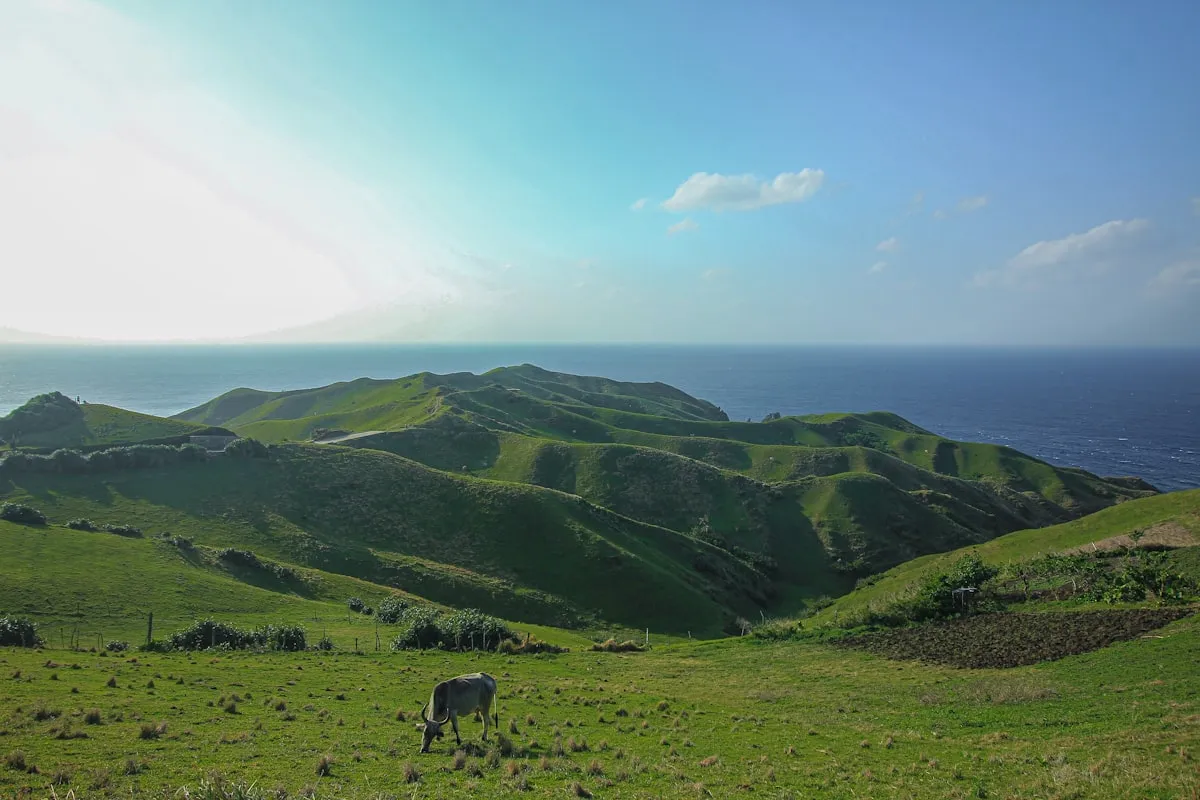
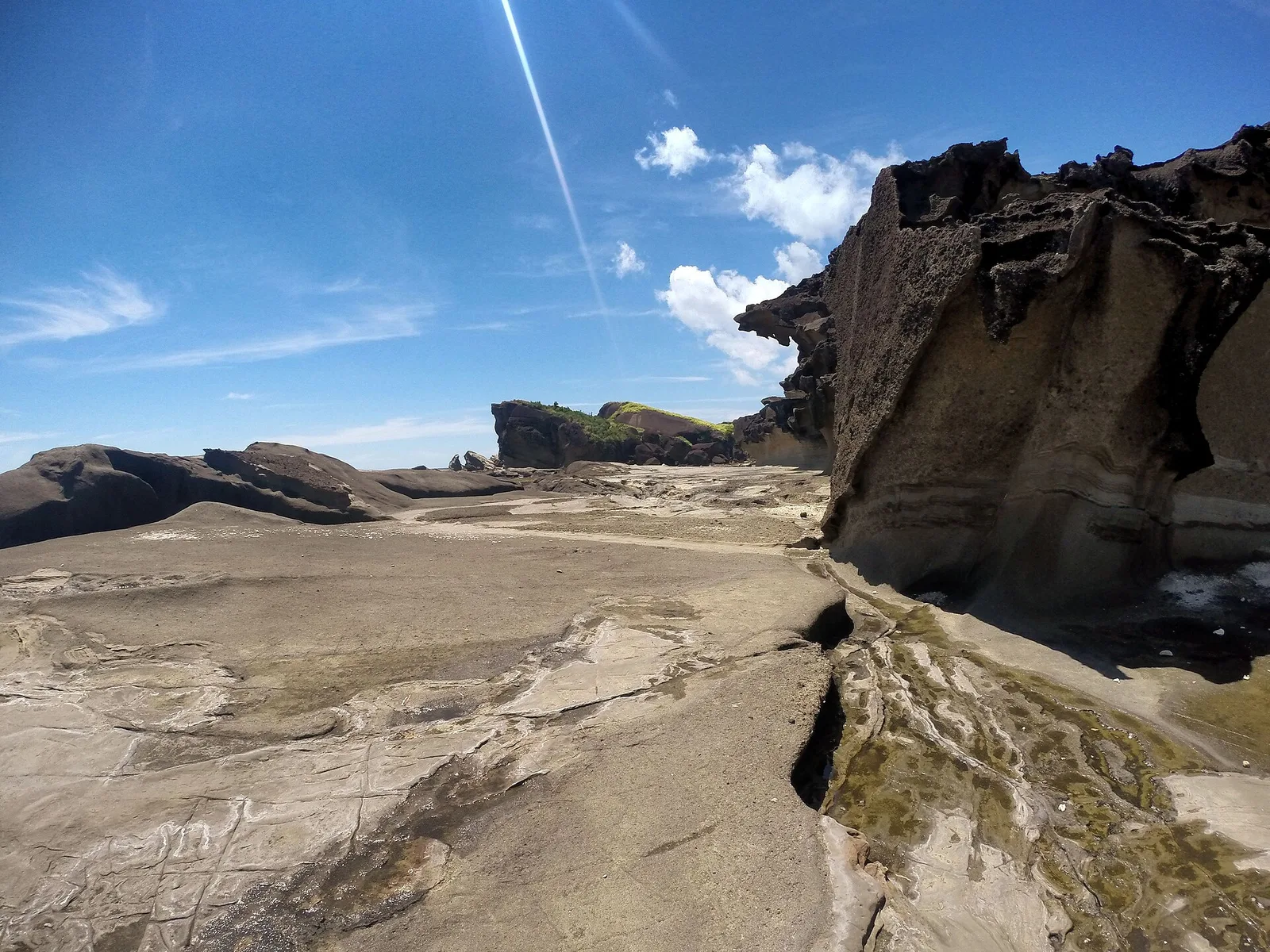
Biri Island sits off the northern tip of Samar in the Philippines, connected to the mainland by a narrow channel and a small town that most travelers have never heard of. It is not a resort destination. It is not a party island. It is a place where sharp, gray limestone towers rise out of the sea like the fins of some ancient creature. The locals say the rocks were shaped by a million typhoons, and while the number is poetic rather than scientific, the idea is easy to believe. Year after year, tropical storms from the Pacific throw waves, wind, and salt against the coast, carving arches, spires, and pools into the stone. The result is a landscape that looks almost impossible for a tropical country.
Biri Island: The Rock Formations Carved by a Million Typhoons
Trip.com
Search on Trip.comHotels in Philippines
Compare live prices via Travelpayouts — targeted for this guide.
Reaching Biri takes effort, which is why it remains quiet even in the middle of the Philippine summer. You fly to Catarman or Calbayog, take a van to the town of Lavezares, cross by boat, and then hire a motorcycle to the jump-off point. Once you are there, the rocks dominate everything. The seven formations have names: Magasang, Magsapad, Macadlao, Puhunan, Bel-at, Caranas, and Pinanahawan. Each has a different shape, a different angle to the sun, and a different difficulty level to reach. This 2026 guide covers the logistics, the costs in Philippine pesos, the formations themselves, and what it feels like to walk on a coastline that nature has been sculpting for thousands of years.
The Seven Formations
The most famous rock group is on the eastern side of the island, facing the open Pacific. Magasang and Magsapad are the two most photographed, often appearing side by side in travel articles and social media posts. Magasang is the one that looks like a giant stone bridge or split arch, with a hole punched through by centuries of wave pressure. Magsapad is narrower and more vertical, a thin tower that seems to lean into the wind. Macadlao and Puhunan are nearby, lower and more rounded, with small tidal pools that trap clear water when the sea pulls back. Bel-at is the largest and most accessible, with a wide platform and shallow pools that are safe for wading. Caranas and Pinanahawan sit further along the coast, less visited but just as dramatic.
The formations are not fenced, and there are no boardwalks. You walk over rough limestone, broken coral, and loose pebbles. Some areas are easy. Others require scrambling. The rocks can be sharp, so open footwear is a bad idea. Most visitors spend a few hours on the eastern coast, moving from one formation to the next as the tide changes. The difference between low and high tide is dramatic. At low tide, the rocks are fully exposed and you can walk between them. At high tide, the waves crash against the bases and the lower formations become impossible or dangerous to reach.
Trip.com
See all tours in Philippines on Trip.comTours & activities in Philippines
Hand-picked experiences in Philippines — book on Trip.com with instant confirmation.
How the Rocks Were Formed
Biri Island is made of Miocene limestone, laid down as sediment millions of years ago and later lifted above the sea by tectonic movement. Once exposed, the stone became a target for erosion. Wind, rain, and the relentless surf of the Pacific began to wear away the softer layers, leaving behind the harder ridges and towers. The process is the same one that creates sea stacks and arches in other parts of the world, but in the Philippines the added force of annual typhoons accelerates it. The waves here carry enormous energy, especially from the east, and each storm reworks the coastline slightly.
Tidal pools are another feature of the erosion. As the water drains at low tide, it leaves behind small basins that trap fish, crabs, sea urchins, and small sea stars. Some pools are deep enough to swim in. Others are shallow and slippery. The colors of the rock range from pale gray to almost orange where iron oxides have stained the surface. In the late afternoon, when the sun is low, the formations cast long shadows and the stone turns gold.
Getting to Biri Island
The nearest airport is Catarman National Airport in Northern Samar. From Catarman, take a tricycle or van to the port town of Lavezares, which takes about thirty to forty minutes. The fare for a tricycle is usually PHP 300 to PHP 500, while a van seat is around PHP 100 to PHP 200. At Lavezares, boats to Biri Island leave from a small pier. The boat ride takes fifteen to twenty minutes and costs PHP 50 to PHP 100 per person, depending on whether you charter the boat or wait for other passengers to fill it. Motorcycle tricycles are available on Biri to take you to the barangay near the rock formations for PHP 200 to PHP 300 per ride.
If you are coming from Tacloban or Calbayog, the van ride to Lavezares is longer but the roads are generally passable. From Tacloban the trip can take three to four hours. From Calbayog it is around two to two and a half hours. The last public boats usually leave Lavezares by late afternoon, so try to arrive before three. If you miss the regular boat, you may have to charter one for PHP 500 to PHP 1,000.
The Local Experience
Biri town is small, friendly, and unaffected by mass tourism. There are a few small guesthouses and homestays, mostly run by local families. A basic room with a fan costs PHP 800 to PHP 1,500 per night. Air-conditioned rooms are rarer and usually run PHP 1,500 to PHP 2,500. Meals are often home-cooked and arranged through your accommodation. Seafood is fresh and abundant. A full meal of rice, grilled fish, and vegetables can cost PHP 150 to PHP 250. There are no large restaurants, no ATMs, and limited mobile signal in some areas, so bring enough cash and let go of the need for constant connectivity.
Guides are not required but are highly recommended. Local boatmen and tricycle drivers often know the best times to visit the formations, the safest routes, and the weather signs. Hiring a local guide for half a day costs around PHP 500 to PHP 1,000, not including the boat or motorcycle. The money goes directly into the community and makes the trip safer, especially if the tide is high or if you want to reach the less visited formations like Caranas and Pinanahawan.
Costs and Practical Budget
A realistic day trip to the Biri rock formations from Catarman, including van, boat, tricycle, guide, meals, and environmental fees, is around PHP 2,000 to PHP 3,500 per person for a solo traveler, less if you split costs with a group. Overnight stays add PHP 1,000 to PHP 2,500 for accommodation. The municipal environmental fee is usually PHP 50 to PHP 100. If you hire a boat just for the crossing, budget PHP 500 to PHP 1,000. Scooter rentals are not widely available, so most visitors rely on the local tricycle network or pay for a package through a homestay.
For a two-day, one-night Biri trip from Tacloban, a budget of PHP 5,000 to PHP 7,000 per person is reasonable. That includes transport to and from Tacloban, the boat, local rides, one night of accommodation, meals, and the guide. If you are traveling alone, the transport costs are higher because the boats and tricycles are priced per trip, not per passenger. Joining a small group or finding other travelers to share the boat is the easiest way to save money.
Best Time to Visit and What to Wear
The dry season from March to June is the most reliable time to visit, with calmer seas and better roads. July to December is typhoon season in Samar, and the seas around Biri can become rough and dangerous. If a storm is in the area, the local government may suspend boat crossings for safety. Even in the dry season, the rocks are hot and exposed. Wear closed shoes or reef shoes with thick soles. Bring a hat, sunscreen, at least two liters of water, and a small first-aid kit. The limestone can cut skin easily, so a bandage and antiseptic are useful.
Timing the visit to low tide is critical. Most of the formations and the walkways between them are only safe at low tide. The safest time is mid-morning to early afternoon, after the morning low tide has drained the pools and before the afternoon high tide returns. The local guide or the boatman will know the daily tide schedule and can suggest the best window. Do not try to climb the rocks when waves are already hitting the base. Wet limestone is extremely slippery and the current can be strong.
Frequently Asked Questions
Is Biri Island safe for non-hikers?
Yes, but some formations are easier than others. Bel-at and the area around Magasang can be reached with light walking. The more remote formations require scrambling and balance. A local guide can match the route to your fitness level.
Are there restrooms or restaurants at the rock formations?
No. There are no facilities at the site. The nearest stores and restrooms are in the barangay before the trail. Use them before heading to the coast. Bring all food and water with you and carry out your trash.
Can I swim at the rock formations?
Swimming is possible in some of the shallow pools and protected areas at low tide, but it is not a swimming beach. The rocks are sharp, the waves can be powerful, and there are no lifeguards. Swim only where the guide says it is safe and avoid the deeper channels where currents run.
How many days should I spend on Biri?
Most visitors do the rock formations in one full day and stay one night on the island. If you want to see the sunset, the less visited formations, and the nearby sandbar, two nights is better. Biri is not a place to rush.
Plan Your Northern Samar Trip with PANA.PH
Discover more places to explore in our destination guides, find a local tour or island package, choose accommodation from our hotel listings, and read more travel guides on the PANA.PH blog.
Sources and Official References
Sources
Primary references for the figures and rules in this guide. Fees and schedules change — check the source before you travel.

PANA.PH Visayas Desk
Visayas travel logistics — Cebu, Bohol, Boracay and Siargao
The Visayas Desk of the PANA.PH travel desk: it maintains and re-checks the visayas travel logistics — cebu, bohol, boracay and siargao data behind the site's guides — operator price lists, official fee schedules and posted timetables — and publishes what it can verify.
🏡 Real local stays (book direct)
Hand-picked homestays and guesthouses — book direct, no markup.
Browse all local stays →
🌊 Popular activities (book instantly)
Island hopping, canyoneering, whale sharks — real Klook/GetYourGuide options.
View all activities →