There is a moment, somewhere south of Coron town, when the engine of your bangka throttles down and the water beneath you turns a shade of turquoise so unr
PANA.PH · Philippines travel teamPublished June 29, 2026 · 6 min read
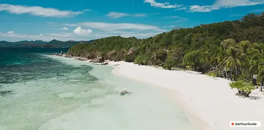
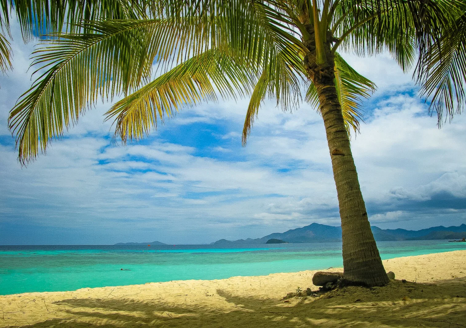
There is a moment, somewhere south of Coron town, when the engine of your bangka throttles down and the water beneath you turns a shade of turquoise so unreal you instinctively reach for your camera before your brain has caught up. This is the southern reef belt of the Calamian Islands, a scatter of low limestone and coral cays far gentler than the dramatic karst towers Coron is famous for. The White Sands and Sandbar Escapade trades the cliff-walled lakes of Coron Island for something softer and dreamier: powder-fine beaches, shallow sandbars that appear and vanish with the tide, and the kind of long, slow lunch under a palm that you will think about for months afterward.
Most first-time visitors to Coron rush straight to Kayangan Lake and Twin Lagoon, and they are right to. But this southern run is the antidote to that intensity. It is wider, breezier, and far less crowded, and it gives you a completely different face of Palawan, one made of sand instead of stone.
Where you actually are: the geography of southern Coron
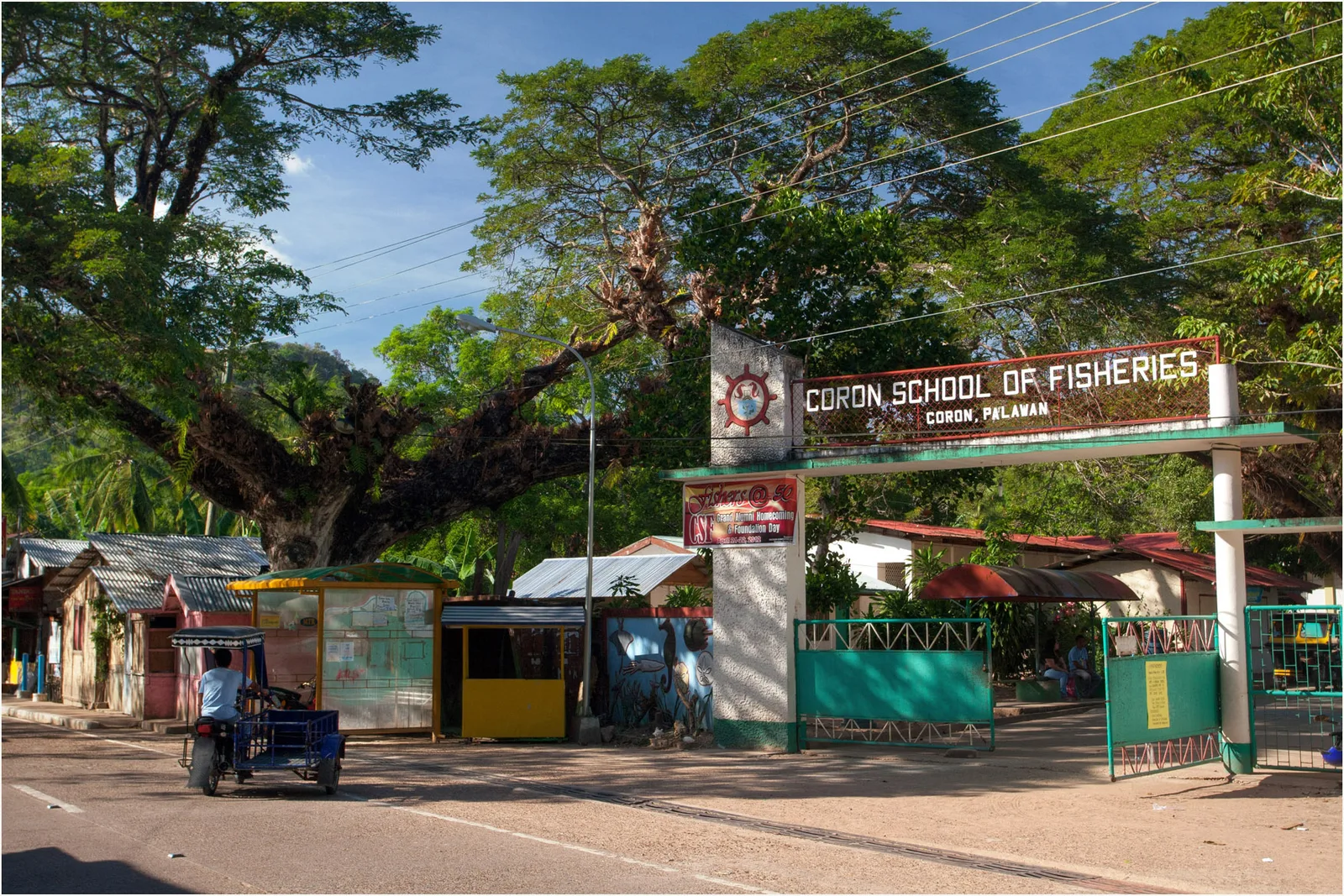
Coron is not a single island but a confusing, wonderful jumble of them in the Calamian group, sitting in the strait between mainland Palawan and Mindoro. The town itself sits on Busuanga Island; the towering black cliffs everyone photographs belong to Coron Island, a separate landmass to the south. This tour pushes further south and east into open water, toward a cluster of smaller, lower islands fringed by coral reef.
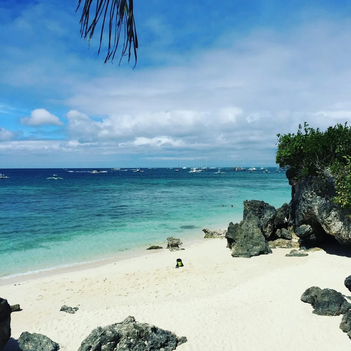
The contrast in geology is the whole point. Coron Island's jagged peaks are ancient karst, limestone laid down as marine sediment and then thrust upward and dissolved over millions of years into the serrated ridgelines you see. The islands on this tour, by contrast, are classic tropical sand cays: their beaches are built from broken-down coral and the calcium-carbonate shells of marine organisms, ground fine by wave action over centuries. That is why the sand here is so blindingly white and so soft underfoot. It is, quite literally, pulverized reef.
The sandbars are the most magical expression of this. A sandbar is simply a ridge of that coral sand deposited by currents in shallow water. At low tide it emerges as a ribbon of dry beach you can walk along with sea on both sides; at high tide it slips back underwater. Because they shift with weather and season, no two visits look exactly alike.
Stop by stop: what the day looks like
Malcapuya Island
Malcapuya is, for many people, the highlight, and it routinely gets called one of the most beautiful beaches in the Calamianes. The main beach is a long, gentle crescent of white sand backed by palms and a low forested hill. The water shelves out slowly, so you can wade a long way before it deepens, which makes it lovely for families and weak swimmers. There is usually decent coral and fish life off to the sides of the bay if you bring a mask and snorkel. A short trail leads over the rise to a quieter second cove on the far side, well worth the ten-minute walk if you want a moment away from the boats. Malcapuya typically carries a small environmental or landing fee, paid locally, which goes toward upkeep of the island.
Ditaytayan (Bulog Dos and the sandbar)
Ditaytayan, sometimes spelled Detaytayan, is sandbar country. The star here is a spectacular natural sandbar that stretches out from the island like a pale tongue into the blue, with shallow water on either side that you can wade across. This is the postcard shot of the southern tour. The exact length and shape of the bar depend entirely on the tide and recent weather, so guides time the visit to catch it well exposed when they can. The island also has hilly viewpoints and quieter beaches, and the snorkeling around the fringing reef can be rewarding. Nearby Bulog Dos is often folded into the same area, another slim sandbar connecting two islets, photogenic and shallow.
Banana Island and Bulog
Depending on the operator and the weather, the loop often includes Banana Island and Bulog, two more white-sand stops in the same neighborhood. Banana Island has a broad swimming beach and is a common lunch stop, while Bulog adds yet another sandbar and good shallow snorkeling. The southern islands cluster close enough together that a single day can string several of them into one easy, sun-soaked circuit.
Lunch is usually a grilled spread served on the beach: fish, pork or chicken, rice, and fresh fruit, often eaten with your feet in the sand. It is one of the genuine pleasures of island-hopping in this part of Palawan.
Why it matters: culture and conservation
These waters are not empty wilderness. The Calamianes are the ancestral home of the Tagbanua people, one of the oldest indigenous groups in the Philippines, who hold ancestral-domain rights over Coron Island and its sacred lakes and exercise real stewardship over how visitors behave there. While the southern islands on this tour fall outside the most tightly controlled Tagbanua zones, the same ethic of respect applies: the landing and environmental fees you pay are part of keeping these places livable for the local communities who manage them.
Conservation is a live issue here. The reefs that built these beaches are fragile, and the region has felt the pressure of warming seas and coral bleaching like reefs everywhere. The simplest responsible-travel rule is the oldest one: do not touch, stand on, or break the coral, do not feed the fish, and take every scrap of trash back to the boat with you. Reef-safe sunscreen, or better yet a rash guard and hat instead of heavy sunblock, makes a real difference in shallow water where chemicals concentrate.
Practical tips for the day
Duration: Plan on a full day, roughly eight to nine hours door to door, with a fair amount of it spent cruising between islands, since the southern cluster is farther out than the Coron Island circuit.
Best time: The dry season, roughly December through May, gives the calmest seas and clearest water. The sandbars look best at lower tide, so an operator who watches the tide tables is worth choosing. Mornings are calmer; afternoons can pick up wind and chop on the open crossings.
Bring: reef-safe sunscreen, a hat, sunglasses, a rash guard, water shoes or sandals, a dry bag for your phone, cash for the local island fees, and your own mask and snorkel if you have them. Bring more drinking water than you think you need.
Strenuousness: Easy. The hardest part is wading off a boat into shallow water and an optional short hill walk on Malcapuya or Ditaytayan. There is little to no shade on the sandbars themselves, so sun protection is the real challenge.
Typically included: the bangka boat and crew, a beach lunch, and usually water and basic snorkeling gear. Local environmental and landing fees are sometimes separate and paid on the islands, so carry small bills.
Responsible note: these are quieter islands with limited facilities. Toilets are basic or absent on the sandbars. Pack out everything, and resist the urge to take "souvenir" shells or sand, which is exactly how a sandbar slowly disappears.
The takeaway
If Coron's lakes are its drama, the southern islands are its calm. This is the tour you do to slow down, to float in water the color of glass, to walk a sandbar that the sea will reclaim by evening, and to eat grilled fish with sand between your toes. It is the gentler, sunnier side of one of the Philippines' most beautiful corners, and for a lot of travelers it ends up being the day they remember best.