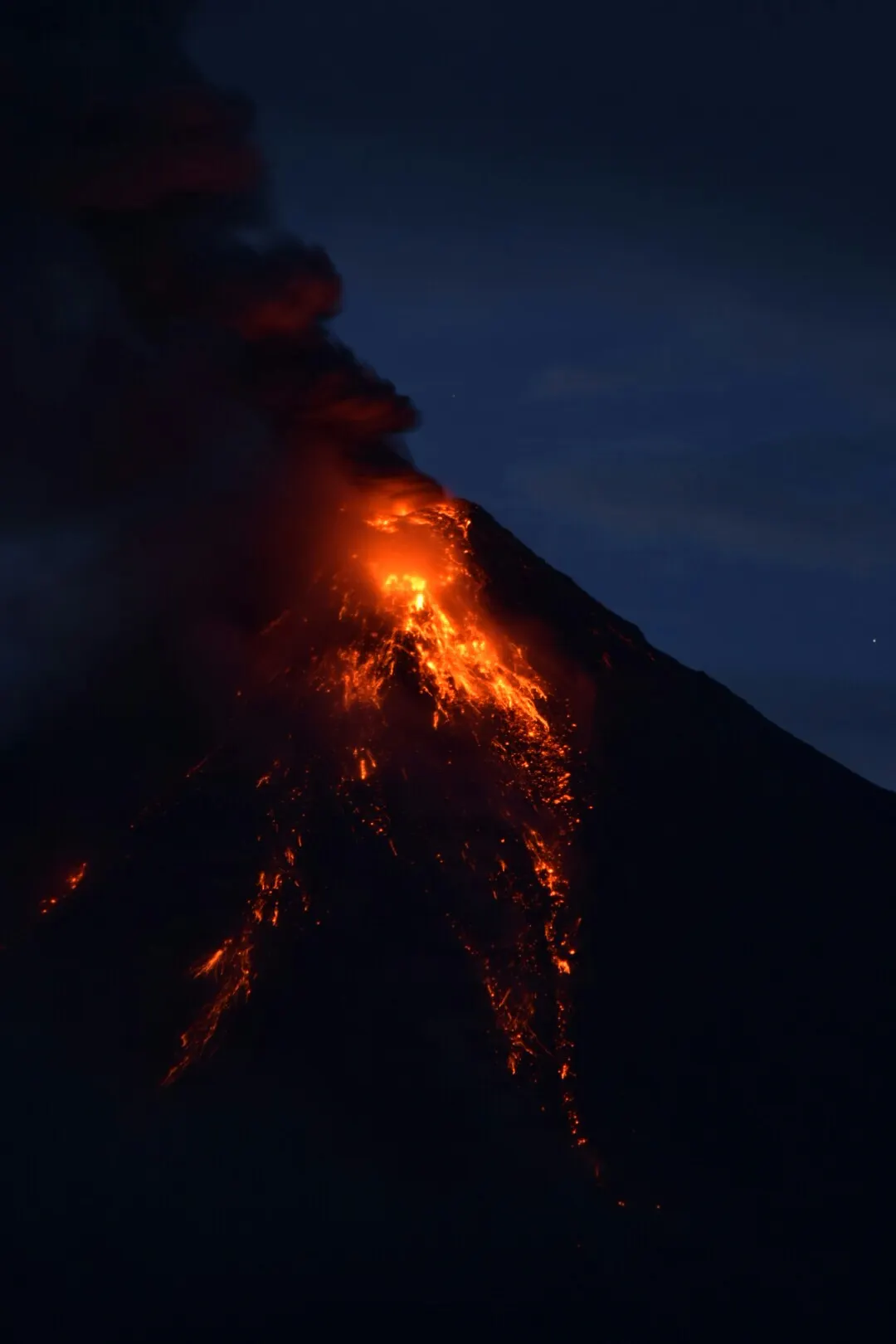
Short answer: PHIVOLCS uses six steps. Level 0 is quiet, Level 1 is low-level unrest, Level 2 means moderate unrest probably of magmatic origin, Level 3 means magma is close to the crater, Level 4 means a hazardous eruption is possible within days, and Level 5 means one is under way. Most tourist closures start at Level 2, not Level 4.
Trip.comHotels in Philippines
Compare live prices via Travelpayouts — targeted for this guide.
Search on Trip.comFor travellers with a volcano on the itinerary - Taal, Mayon, Kanlaon, Bulusan, Pinatubo - who want to know what a headline alert level actually changes. Scale definitions last checked 30 July 2026 against the PHIVOLCS alert-level page. Alert levels change without notice; check the number on the day, not the week before.
| Level | PHIVOLCS description | What it usually means for a visitor |
|---|
| 0 | Quiet. No eruption in the foreseeable future | Normal access |
| 1 | Abnormal. Low-level unrest, no eruption imminent | Access usually normal, crater may be restricted |
| 2 | Increasing unrest, probably of magmatic origin | Crater and inner danger zone typically closed |
| 3 | Relatively high unrest, magma close to the crater | Wider evacuation zone, tours suspended |
| 4 | Intense unrest, hazardous eruption possible within days | Evacuations, airspace and road closures |
| 5 | Hazardous eruption in progress | Emergency response, region-wide disruption |
What each of the six alert levels actually means
The PHIVOLCS alert-level scheme is a reference for the state of an active volcano, the level of threat it poses, and the steps needed for public safety. Levels 1 to 5 correspond to increasing severity of unrest, with Level 0 sitting below them as the quiet baseline.
The step that carries the most information is Level 2. It is described as moderate unrest that is probably of magmatic origin and could eventually lead to eruption - which is a materially different statement from Level 1, where unrest is present but not attributed to magma moving. Level 3 escalates again: relatively high unrest with magma close to the crater.
Levels 4 and 5 are the ones that make international news. Level 4 means intense unrest with a hazardous eruption possible within days. Level 5 means a violent eruption is actually taking place. By the time either is declared, the travel decision has been made for you.
Permanent danger zones are drawn on a map, not decided on the day
Every Philippine volcano under monitoring has a permanent danger zone - a fixed radius around the vent that is off limits regardless of the current alert level. Mayon's is a six-kilometre radius, and it is the reason villages inside it are evacuated whenever unrest rises.
This is the part travellers misread most often. The danger zone is not created when the alert level goes up; it exists permanently, and a rising alert level triggers an extended danger zone on top of it. Being outside the permanent zone during Level 1 is not the same as being safe at Level 3.
Practically, it means viewpoints and towns at a distance often stay open while everything inside the radius closes. A Mayon trip can still work from Legazpi when the summit approach is shut, and a Taal view from the Tagaytay ridge is a different proposition from landing on Volcano Island.
Alert Level 2 is where most travel plans quietly break
Travellers watch for Level 4 headlines and are then surprised when a Level 2 volcano has already closed the thing they booked. Level 2 is common, it is undramatic, and it routinely suspends crater access, boat landings and guided ascents.
Multiple Philippine volcanoes sit at elevated alert simultaneously for long stretches. During 2026 that has included Mayon, Kanlaon and Taal at raised levels at the same time, with thousands evacuated from danger zones. None of that produces a news cycle abroad, and all of it changes what an operator can legally sell you.
The lesson for planning is to treat any volcano itinerary as conditional. Book the trip, but do not build a non-refundable week around standing on a crater rim.
Who closes what: PHIVOLCS advises, the local government decides
PHIVOLCS is a scientific agency. It monitors, it raises and lowers alert levels, and it issues bulletins. What it does not do is close a road, cancel a boat or evacuate a barangay - those are decisions of the local government unit and the disaster risk reduction council, acting on the PHIVOLCS assessment.
That division explains contradictions travellers run into. A volcano can be at the same alert level in two provinces with different access rules, because two local governments made different calls. It also explains why an operator may still be selling a tour that the municipality has suspended - the seller and the closer are not the same body.
When the two disagree, the local government's position is the one that determines whether your boat leaves. The Department of Tourism is the right escalation point for questions about accredited operators still selling suspended activities.
Checking the level yourself before you fly
The number is published, free and updated continuously on the PHIVOLCS site, which carries daily bulletins for each monitored volcano alongside the alert level. That is the primary source; everything else is a repackaging of it, usually a day behind.
Check it twice: once when you book, once in the 48 hours before you travel to the volcano. Alert levels move in both directions, and a downgrade opens access as abruptly as an upgrade closes it.
Pair it with PAGASA for weather. Heavy rain on a volcano with fresh ash deposits produces lahar, a fast debris flow that has historically killed more people than the eruptions themselves. A quiet volcano in a typhoon is not automatically a safe one.
What most guides get wrong about volcano alerts
The first and most common error is treating anything under Level 4 as fine. Guides write that a volcano is at Level 1 or 2 and therefore visitable, when Level 2 explicitly describes unrest probably of magmatic origin that could lead to eruption, and routinely closes crater access. The scale is not a two-state system with a warning light at the top.
The second is presenting the alert level as an access rule. It is a hazard assessment. Access is decided by local governments, which is why an article stating that a particular level means a particular site is open is making a claim PHIVOLCS never made.
The third is ignoring lahar entirely. Coverage focuses on eruptions and skips the mechanism that made Pinatubo lethal for years after 1991 - rain mobilising loose ash and debris into flows that travel far beyond any crater radius. A guide that discusses volcano safety without mentioning rain has left out the part that most often affects travellers.
Frequently asked questions
What does Alert Level 2 mean for a volcano tour?
Moderate unrest, probably of magmatic origin, that could eventually lead to eruption. In practice crater access and boat landings are usually suspended at Level 2, even though it makes no international headlines.
How many alert levels does PHIVOLCS use?
Six, from Level 0 to Level 5. Levels 1 through 5 mark increasing severity of unrest; Level 5 means a hazardous eruption is actually in progress.
Is a permanent danger zone the same as an evacuation zone?
No. The permanent danger zone is a fixed radius that is always off limits - six kilometres at Mayon. Rising alert levels add an extended danger zone on top of it.
Who decides whether a volcano site closes?
The local government unit and its disaster risk reduction council, acting on the PHIVOLCS assessment. PHIVOLCS sets the alert level but does not close roads, boats or trails itself.
Where do I check the current alert level?
The PHIVOLCS website, which publishes daily bulletins per monitored volcano. Check once at booking and again within 48 hours of travelling, since levels move both up and down.