PHPANA.PH · Philippines travel teamPublished June 29, 2026 · 7 min read
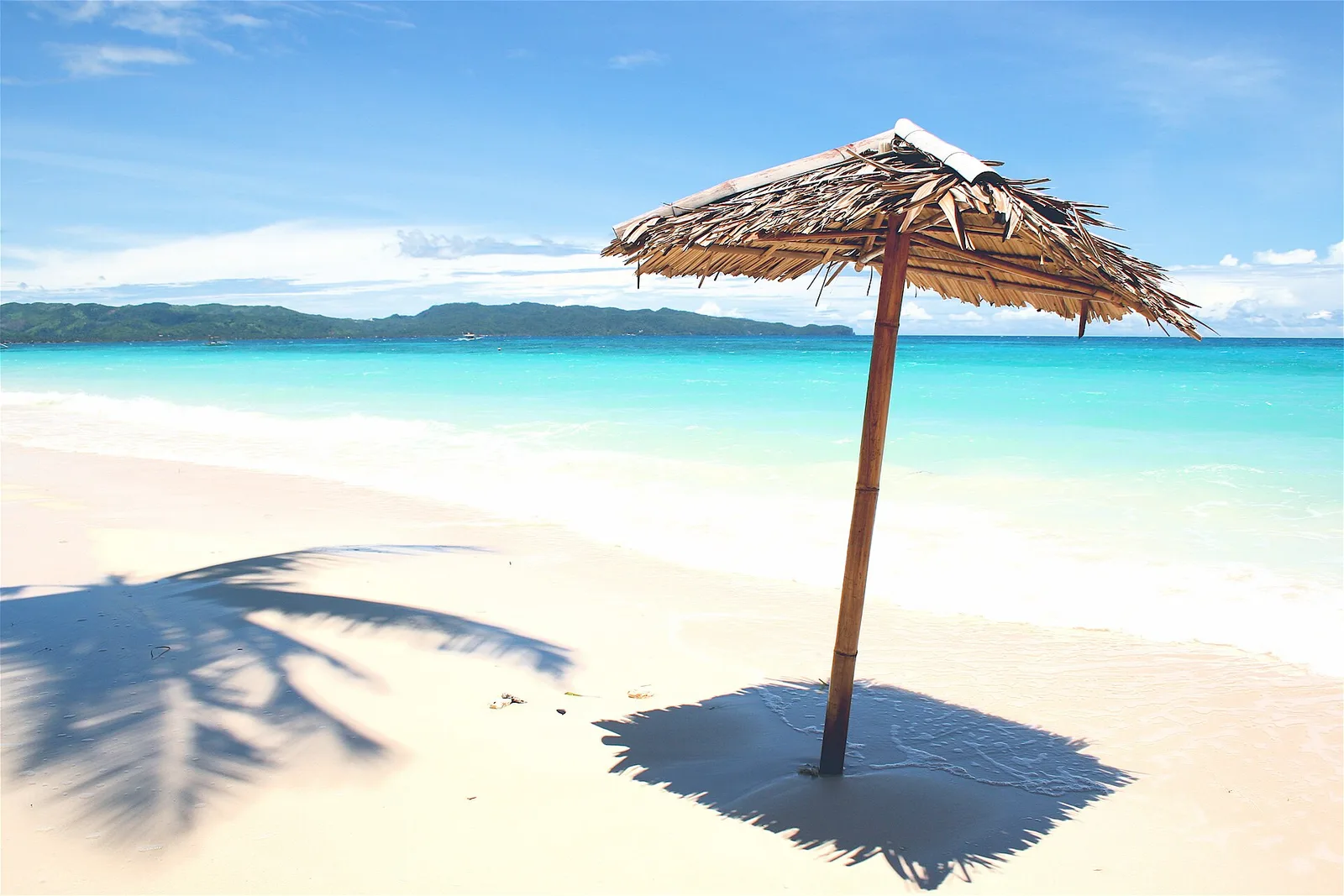
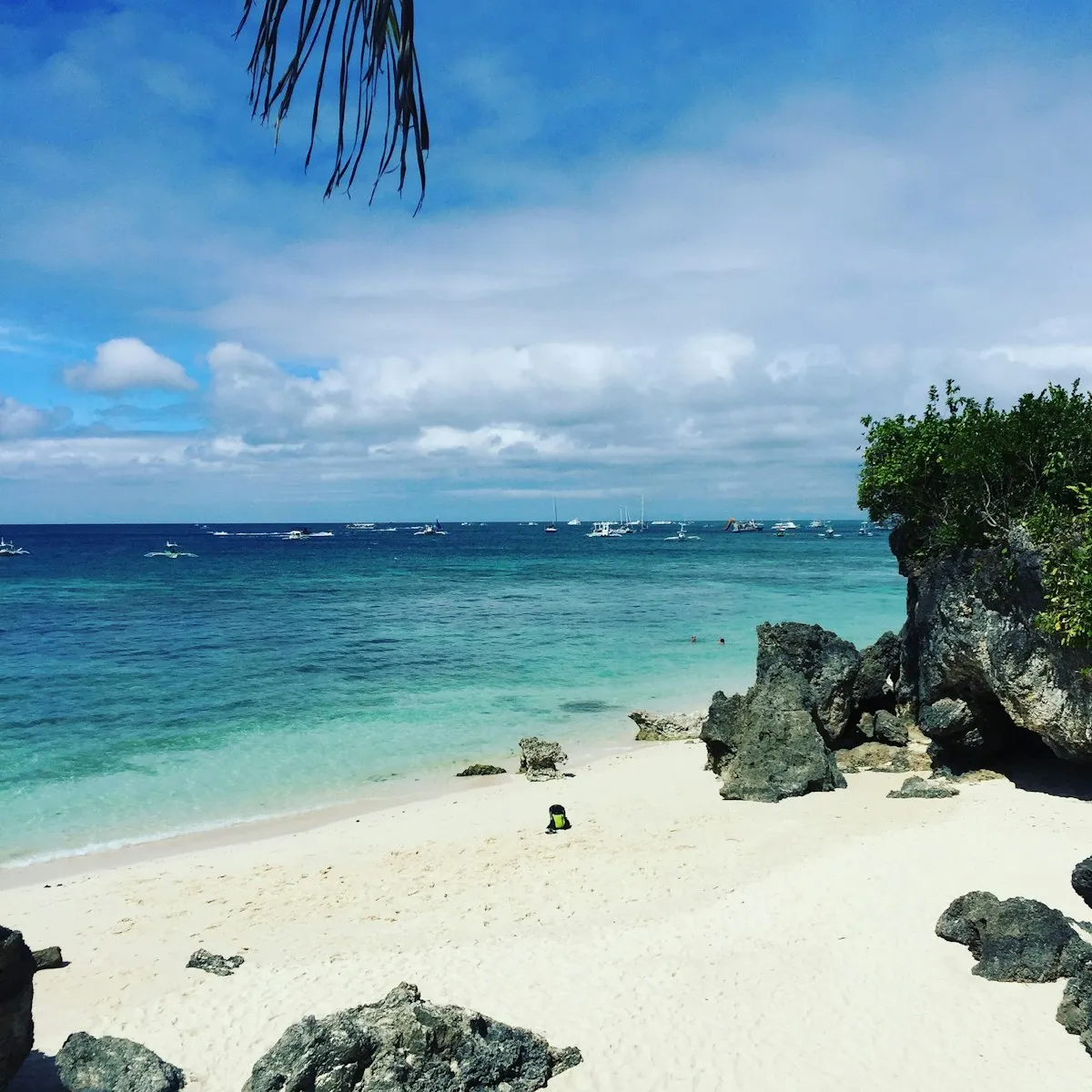
There is a moment on Boracay's White Beach, usually somewhere between four and six in the afternoon, when the whole island seems to slow down. The fierce midday glare softens to gold, the powder-fine sand turns warm underfoot, and the line of bancas bobbing offshore catches the light. Right in the middle of all this, planted in the shallows where the gentle surf laps at its base, stands a strange little hump of rock crowned by a white grotto. That is Willy's Rock, and it has become the unofficial emblem of the island. A Boracay land tour built around Willy's Rock and the Keyhole formation is the gentlest, most accessible way to read the island's geological story while still ending the day with the famous sunset over the Sibuyan Sea.
This is not a strenuous adventure. It is a walking and short-transfer tour, ideal for families, older travelers, and anyone who wants to understand what they are looking at rather than just snap a photo and move on. Think of it as Boracay slowed to a stroll, with a guide pointing out the things you would otherwise walk straight past.
The island under your feet: how Boracay was built
Boracay is a small island, only about seven kilometers long, lying just off the northwest tip of Panay in the province of Aklan, in the Western Visayas. It is shaped a little like a dumbbell or a dog bone, narrow in the middle and bulging at both ends, with White Beach running down the leeward western side. That famous four-kilometer stretch of sand is what draws most visitors, but the rock formations on this tour tell a more interesting story about how the island actually came to be.
Book Philippines tours & activities
Island hopping, whale shark watching, canyoneering and more. Best prices on GetYourGuide & Klook.
Boracay sits on a foundation of older volcanic and metamorphic rock, but the dramatic features you see along the coast, the headlands, the small caves, and the isolated stacks like Willy's Rock, are largely the work of the sea acting on raised coral limestone. Over many thousands of years, reef-building corals laid down hard calcium carbonate; tectonic activity and changing sea levels lifted some of this rock above the waterline. Waves, rain, and the slightly acidic action of seawater then went to work, dissolving and undercutting the softer parts and leaving the resistant cores standing. Willy's Rock is essentially one of these erosion-resistant outcrops, a sea stack stranded in the shallows as the softer surrounding material wore away.
That same process of coastal erosion explains the famous white sand. Boracay's sand is not silica like most beaches; it is finely ground coral and the calcareous remains of marine organisms, which is why it stays remarkably cool underfoot even at noon and feels like talcum powder rather than grit.
Willy's Rock
Willy's Rock sits in the water off Station 1, the quieter, more upscale northern stretch of White Beach. At low tide you can walk right out to it across the sand and shallow water; at high tide the base is partly submerged and the rock appears to rise straight out of the sea. A small flight of stone steps climbs the formation to a white grotto sheltering a statue of the Virgin Mary, the Our Lady of the Immaculate Concepcion, which gives the otherwise raw geology a quiet devotional character that is very Filipino. Locals and visitors alike pause here, and you will often see small offerings or candles.
Your guide will time the visit to the tide, because the experience changes completely depending on the water. Early morning and the golden hour before sunset are when the light is kindest for photographs and the crowds thinnest.
The Keyhole and the island's hidden coves
The other headline stop is the Keyhole, a natural arch and rock passage formed where the sea has punched clean through a limestone headland. Wave action concentrates its erosive force on cracks and weak points in the rock; over time a notch becomes a cave, and a cave eventually breaks through to form an arch, a "keyhole" framing the water and sky beyond. These features are scattered around Boracay's rockier northern and eastern shores, away from the smooth sweep of White Beach, and they make for some of the most striking framed photographs on the island. Depending on the operator and the tides, the land tour may pair the Keyhole with nearby viewpoints and small coves such as those around the northern bluffs.
People, history, and why the island looks the way it does today
Long before resorts, Boracay was home to the Ati, the indigenous people of Panay and one of the Philippines' Negrito groups, who lived by fishing and gathering. Their presence is still marked by the Ati community and the annual Ati-Atihan-influenced traditions of the wider region. The island remained a quiet, hard-to-reach fishing community well into the twentieth century, only gaining international attention as a backpacker secret in the 1970s and 1980s before exploding into one of Asia's most famous beach destinations.
That fame came at a cost, and it is impossible to tell Boracay's story honestly without it. In 2018 the Philippine government took the extraordinary step of closing the island to tourists for six months for environmental rehabilitation, after years of unchecked development had overwhelmed the sewage system and degraded the surrounding waters. Drainage was rebuilt, illegal structures set back from the beach, and the beachfront easement cleared. A land tour today moves through an island that is visibly cleaner and more regulated than the pre-2018 version, and your guide can explain the rules now in force, from the ban on drinking, smoking, and littering on the beach to limits on building near the waterline.
What it is like to do, and how to do it well
A Boracay land tour of Willy's Rock and the Keyhole is short and easy, typically running a couple of hours, sometimes a little more if a sunset finale and extra viewpoints are included. You will do some walking on sand and stone, and around the Keyhole the footing can be uneven, so this is the one place to take care. There is no real fitness requirement, and most of the day is spent strolling, pausing, and photographing.
- Best time of day: late afternoon into sunset is the classic choice, both for the light at Willy's Rock and for the famous Sibuyan Sea sunset over White Beach. Early morning is the alternative if you want solitude and cooler temperatures.
- Best time of year: the dry Amihan season, roughly late November through May, brings calm seas and reliable sun, with the peak around December to April. The Habagat (southwest monsoon) from June to October is greener and cheaper but wetter, with rougher water on the western beach.
- Mind the tide: walking out to Willy's Rock is easiest at low tide. A good guide plans the route around the day's tide table, so trust the timing.
- What to wear and bring: light, breathable clothing, sandals or water shoes with grip for the rocks, a hat, and reef-safe sunscreen. Bring water, and a small dry bag for your phone if the surf is up.
- Responsible travel: do not climb on or chip at the rock formations, do not touch or stand on coral, and carry out everything you bring in. The island's recovery is real but fragile, and the beach rules are enforced. Willy's Rock grotto is a place of devotion for many locals, so be respectful around the statue.
- Typically included: a guide and the walking route; specifics like transfers, refreshments, or photo stops vary by operator, so check what your booking covers before you go.
A gentle way to fall for Boracay
What makes this tour worth your afternoon is not adrenaline but understanding. You leave knowing that the white sand under your toes is pulverized coral, that Willy's Rock is the stubborn survivor of an eroding limestone coast, and that the Keyhole is the sea slowly carving a doorway through stone. You will have watched the light go gold over the Sibuyan Sea, and you will look at the postcard image of Boracay differently afterward, as a living, hard-won landscape rather than just a pretty beach. Come for the photographs, stay for the story, and let the island reveal itself one quiet rock at a time.