Short answer: Proclamation No. 1037, signed 1 July 1997, made the Chocolate Hills a National Geological Monument and protected landscape. Building inside that area without an environmental compliance certificate exposes the developer to fines from PHP 1 million to PHP 5 million and six to twelve years imprisonment. For visitors it means the legal viewpoints are the built ones, and off-hill wandering is not permitted.
Trip.comHotels in Philippines
Compare live prices via Travelpayouts — targeted for this guide.
Search on Trip.comFor travellers planning a Bohol countryside day and wondering why some viewpoints closed and others did not, and for anyone booking a resort that advertises a hill view. Proclamation details, enforcement dates and penalty ranges last checked 30 July 2026 against national reporting and the protected-area framework.
| Instrument or event | Date | What it established |
|---|
| Proclamation No. 1037 | 1 July 1997 | Chocolate Hills declared a National Geological Monument and protected landscape |
| Temporary Closure Order, Captain's Peak | 6 September 2023 | Resort operating inside the protected area ordered shut |
| Notice of Violation issued | 22 January 2024 | Formal violation recorded for operating without an ECC |
| Penalty exposure under protected-area law | Current | PHP 1 million to PHP 5 million; 6 to 12 years imprisonment |
Proclamation 1037 is why you cannot build there
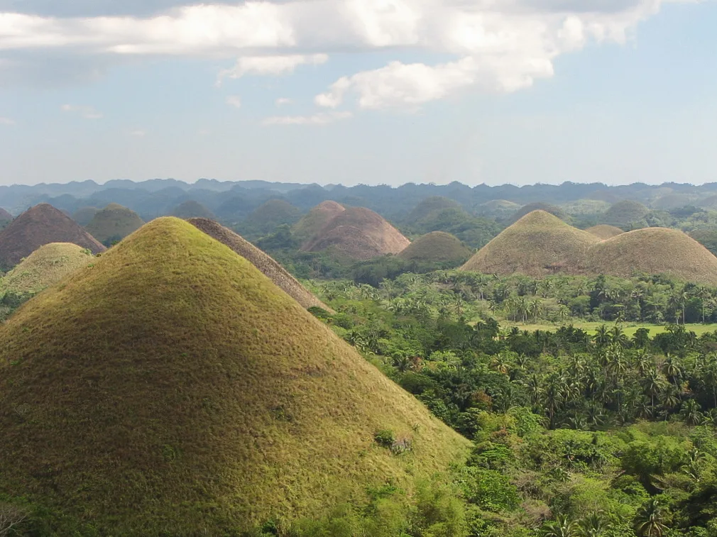
The Chocolate Hills are not a scenic area that the province asks people to treat kindly. They are a legally designated protected landscape, declared a National Geological Monument by presidential proclamation in July 1997, and administered within the national protected-area system that the DENR oversees.
That status carries specific consequences. Development inside the boundary requires clearance, structures require permits, and an environmental compliance certificate is not paperwork that can be regularised afterwards. The designation covers the hills and the land between them, which is the part developers have repeatedly treated as available.
For a visitor the practical translation is simple: the hills are not a place you walk into. Access is through designated viewpoints, and the reason there are only a handful of them is regulatory rather than logistical.
What the Captain's Peak closure established
A resort built within the protected area became the test case. The DENR had issued a temporary closure order on 6 September 2023, followed by a notice of violation on 22 January 2024 for operating without an environmental compliance certificate. The case drew national attention, senators called for demolition, and the department moved to repeal the administrative orders that had previously been read as permitting structures inside the area.
One of those readings - a policy treated as allowing development on a portion of the protected area - was publicly described as illegal during the review. The direction of travel since has been toward removing structures rather than licensing them.
What this establishes for travellers is that a business operating in view of the hills is not necessarily operating lawfully inside them, and that an accommodation advertising a position among the hills is worth a second look. A closure order mid-stay is a poor souvenir.
Penalties written into the protected-area law
The numbers attached to the Captain's Peak case are the ones to remember: a fine exposure running from PHP 1 million at the low end to PHP 5 million at the maximum, and imprisonment of six to twelve years for erecting structures without the appropriate permits inside a protected area.
Those penalties fall on developers and operators, not on tourists. No visitor is going to jail for standing in the wrong field. But the severity explains the posture you will meet on the ground - guides who will not take a detour, viewpoints with fixed boundaries, and staff who are firm about where the path ends.
The provincial government of Bohol and the Philippine News Agency have both tracked the enforcement sequence, and they are better references than a tour operator's account of why a particular spot is closed.
Tarsier viewing has its own enforceable code
The other half of a Bohol countryside day is the tarsier, and it comes with rules that are stricter than most visitors expect. At the sanctuary in Corella, the Philippine tarsier is viewed under conditions designed around an animal that is acutely sensitive to light and noise: no touching by visitors at all, handling by staff only, no flash photography, and silence in the viewing area.
These are not decorative requests. Stress responses in captive and semi-wild tarsiers are well documented, and the sanctuary model exists because roadside operations holding tarsiers for photographs produced measurably worse outcomes for the animals.
The practical filter is easy. If a stop offers you a tarsier on your hand or a photograph with flash, it is not the conservation sanctuary, whatever the sign says. Ask which site your tour includes before you book, not when you arrive.
Choosing a viewpoint that is legally inside the rules
The Carmen complex is the established public viewpoint, with the climb to the observation deck and the panorama most photographs come from. Sagbayan Peak is the second recognised option, further west and generally quieter. Both are built facilities with defined boundaries, which is exactly what makes them uncontroversial.
Anything beyond that deserves a question. A viewpoint reached by a private road, a drone launch from inside the hills, or a hillside stay marketed as being within the formation are all in territory that enforcement has been actively contesting.
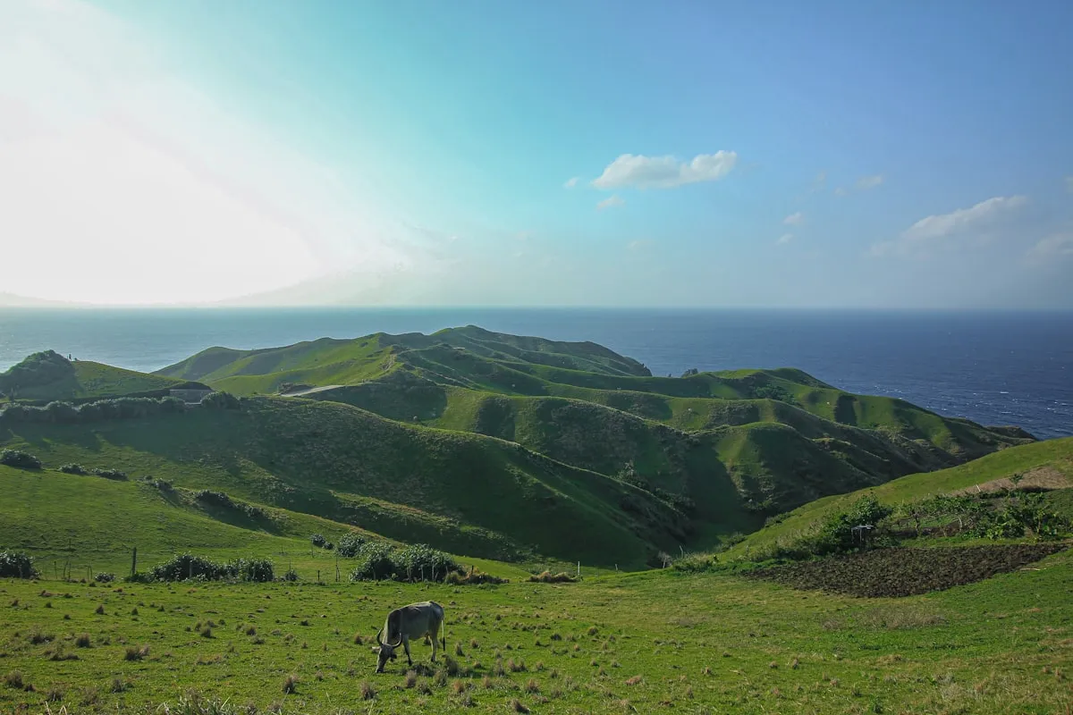
Timing matters more than location for the photograph anyway. The hills turn their namesake brown in the dry months as the grass cures, and they are green for much of the rest of the year - the same viewpoint delivers two different pictures depending on when you stand on it.
What most guides get wrong about the Chocolate Hills
The most common error is describing the hills as a national park. They are a National Geological Monument and a protected landscape under a 1997 proclamation, which is a different legal instrument with a different management structure. The distinction sounds pedantic until you are reading about why a resort was closed and the framework matters.
The second is the persistent claim that there are exactly 1,268 hills, or exactly 1,776, quoted with a confidence the underlying surveys do not support. Counts vary by survey method and by where the boundary is drawn across roughly fifty square kilometres. A guide quoting a precise figure without a source is repeating a number, not reporting one.
The third and most useful correction concerns the tarsier. Guides routinely present the Corella sanctuary and roadside tarsier stops as interchangeable items on a countryside tour. They are not. One is a conservation facility with enforced no-touch, no-flash rules; the others are photo operations. Booking a countryside package without asking which one you are being taken to is how well-meaning visitors end up funding the wrong model.
Frequently asked questions
Are the Chocolate Hills a national park?
Not exactly. Proclamation No. 1037 of 1 July 1997 declared them a National Geological Monument and a protected landscape, administered under the national protected-area system rather than as a national park.
Why was a resort in the Chocolate Hills closed?
Captain's Peak Garden and Resort was operating inside the protected area without an environmental compliance certificate. The DENR issued a temporary closure order on 6 September 2023 and a notice of violation on 22 January 2024.
Can I walk among the hills themselves?
No. Access is through designated viewpoints such as the Carmen complex and Sagbayan Peak. The protected-landscape designation covers the hills and the ground between them, and off-viewpoint access is not permitted.
Can I hold a tarsier in Bohol?
Not at the conservation sanctuary in Corella. Visitors do not touch the animals, only staff handle them, flash photography is banned and silence is required. Any stop offering a tarsier on your hand is a different operation.
When are the hills actually brown?
In the dry months, when the grass covering them cures and turns the chocolate colour they are named for. For much of the rest of the year the same viewpoints look green.
Book tours, hotels & stays in Chocolate Hills Protected Landscape
Top tours
Top hotels
Top stays