Mt. Pulag
The highest peak in Luzon — and the sea of clouds that forms above the pygmy forest at dawn · Benguet, Cordillera, Luzon
Photo: Firth m / CC BY-SA 4.0 via Wikimedia Commons
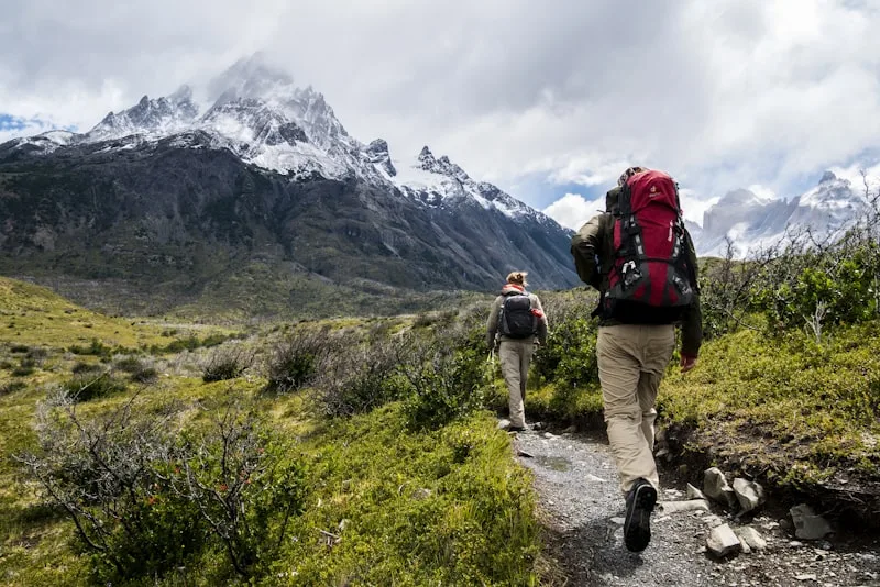
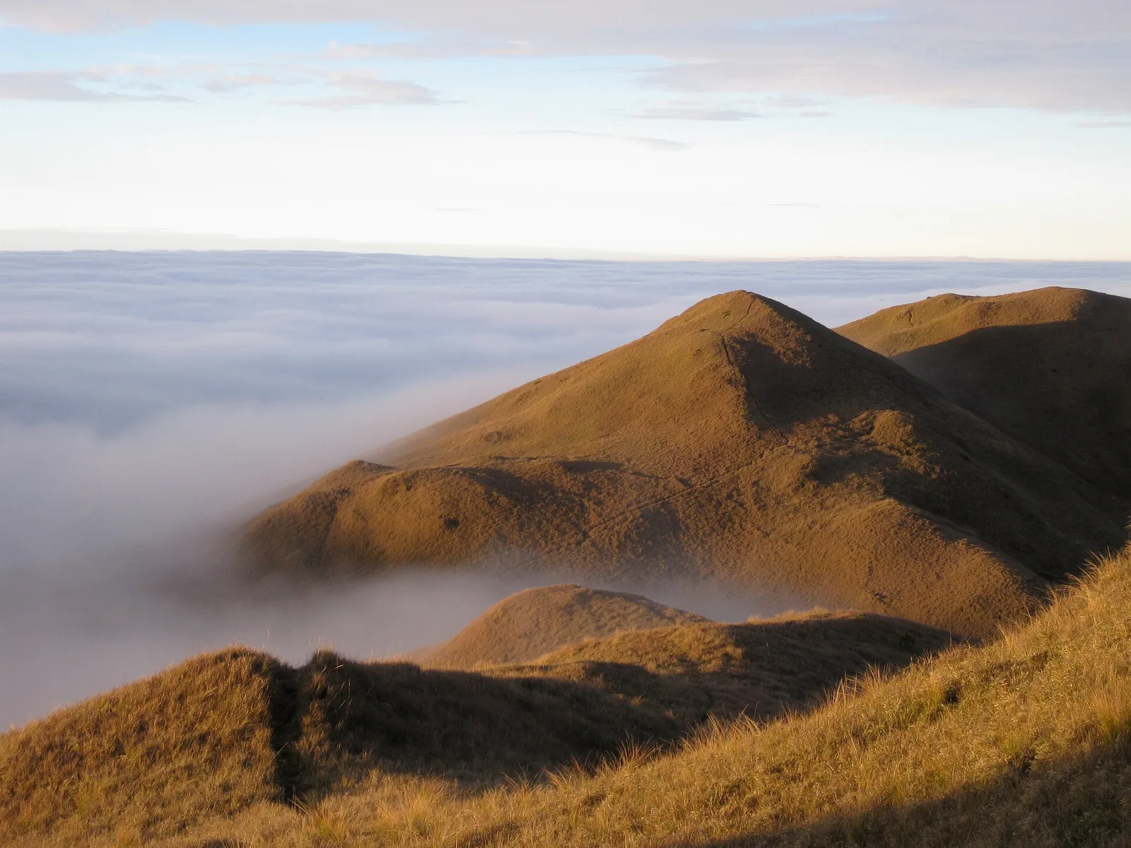
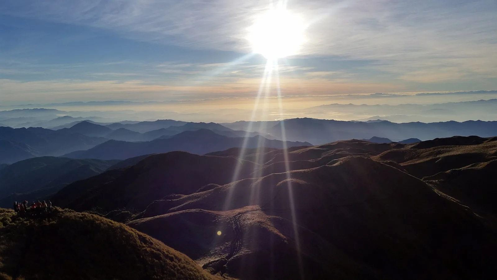
Mount Pulag, at 2,922 metres above sea level, is the highest peak in Luzon and the third highest in the Philippines. It sits in Benguet Province in the Cordillera, about 60 kilometres northeast of Baguio City, and its summit is the centre of the Pulag National Park — a protected area covering 11,550 hectares of montane forest, mossy forest, and the extraordinary pygmy forest that occupies the higher elevations. Hikers come primarily for two things: the summit, which offers a 360-degree view of the Cordillera ranges; and the sea of clouds — the phenomenon that occurs on most clear mornings when the valleys below fill with fog while the summit stands clear above the white surface, giving the impression of walking on clouds. The sea of clouds typically forms between 5:00 and 7:00 AM, which is why most groups camp at the summit area and wake for sunrise. Mt. Pulag is a managed climb with a strict permit system — this keeps the trail conditions reasonable and limits the number of people at the summit on any given morning.
Things to do in Mt. Pulag
The Sea of Clouds at Summit Sunrise
The defining Pulag experience: wake at 4:00–4:30 AM, walk the final 30 minutes to the summit, and wait for dawn. When the valley fog settles below the treeline and the sun rises from the east, the landscape below the summit disappears into a white ocean. On the best mornings, only the highest peaks of the Cordillera break the surface. The temperature at this hour is often below 10°C — bring thermal layers regardless of how warm the daytime ascent felt. Most campers describe the moment as one of the most affecting in Philippine trekking.
Ambangeg Trail (Beginner to Intermediate)
The Ambangeg trail is the easiest route to the Pulag summit — a 4-hour ascent through mossy forest to the camping area at Camp 2 (2,600m), then a 1-hour summit walk. The trail is wide, well-maintained, and does not require technical climbing. It is the most popular route and the one most day-trippers use. The gradual ascent through the mossy forest — gnarled trees draped in hanging moss, endemic pitcher plants at higher elevations, and the dwarf bamboo grassland near the summit — is beautiful enough that the destination is almost secondary.
Akiki Trail (Advanced, 2-Day)
The Akiki trail is the demanding alternative — a steep 10–12 hour ascent from Kabayan town through primary forest and exposed ridges to the summit campsite. Most trekkers do Akiki as an ascent and descend via Ambangeg (traverse). The trail passes through primary forest with no Ambangeg-style wide path; the terrain demands fitness and proper footwear. The views from the Akiki ridgeline, looking back over Kabayan Valley and forward to the summit plateau, are superior to anything visible from Ambangeg. Permits for Akiki are the same as Ambangeg but the guide is more important.
Pygmy Forest and Endemic Plants
The summit plateau of Mt. Pulag is covered in a high-altitude pygmy forest — stunted trees, often less than 2 metres tall, shaped by the wind and cold, draped in hanging moss. This ecosystem is unique to the highest elevations of the Cordillera and is home to endemic plant species including several Rhododendron and orchid species. The pitcher plant (Nepenthes) found in Pulag — specifically the carnivorous Nepenthes benguetensis — is endemic to the mountain. Rangers will point out significant specimens along the Ambangeg trail without requiring you to leave the path.
Kabayan Mummy Caves (Day Before / After Climb)
The town of Kabayan holds one of the most remarkable archaeological collections in Southeast Asia: the fire-mummified remains of Ibaloi ancestors, interred in burial caves on the mountainside above the town. The Kabayan mummies are estimated to be 500–3,000 years old. The Opdas Burial Cave is the most accessible (30-minute walk from town, guide from the museum required). The National Museum maintains a site museum in Kabayan town with artefacts and context. Combining the mummy caves with the Pulag climb — one evening before the trek — adds a significant cultural dimension to the itinerary.
Photos of Mt. Pulag
A visual taste of Mt. Pulag before you go.
Photos: Firth m (CC BY-SA 4.0) via Wikimedia Commons · Andre Lloyd Torres (CC BY-SA 4.0) via Wikimedia Commons
Ready to book?
Book your Mt. Pulag trip now
Hotels, tours and transfers — compare live prices and book securely through trusted partners. Prices update daily.
Affiliate links — we earn a small commission at no extra cost to you. Prices shown are live from our partners.
🗓️ Best time to visit Mt. Pulag
November through April is the dry season and the clearest window for the sea of clouds. January and February are the coldest months (summit temperatures can drop to 1–5°C before dawn) and the most reliable for cloud formation. March through May is warmer but still manageable. October through December is the transition from wet to dry season — variable but often produces dramatic skies. June through September is the rainy season; the trails become muddy and cloud views are obscured, though the mossy forest is at its most lush.
✈️ How to get to Mt. Pulag
From Baguio City: take a bus or van to Kabayan, Benguet (3–4 hours, PHP 150–200) — Kabayan is the jumping-off town for all Pulag trails. The most accessible trail (Ambangeg) starts near the DENR Visitors Center in Barangay Eddet, 20 minutes from Kabayan by habal-habal. From Manila: bus to Baguio (6–8 hours, PHP 500–700) then onward to Kabayan. All climbers must obtain a permit from the Protected Area Office (PAO) in Kabayan — day-tripper permit PHP 400, overnight permit PHP 600. Permits must be secured before 2 PM for same-day use. A registered guide is mandatory (PHP 700–1,000/group/day).
Plan your Mt. Pulag trip
Compare hotels and tours — booked through trusted partners. Use the planner on /plan to turn this guide into a full day-by-day itinerary.
🗓️ Use this guide in your plan
Build a Mt. Pulag trip directly. The planner combines it with real flights, stays and tours into one day-by-day itinerary.
✨ Open Trip PlannerOne of 215+ destinations covered. Explore more at /guides and /blog.
Frequently asked questions — Mt. Pulag
How cold is it at the Mt. Pulag summit?
Summit temperatures at dawn range from 1°C to 10°C depending on the season. January and February are the coldest months, with occasional frost on the summit grassland. Even in March and April, pre-dawn temperatures are below 10°C. Bring: thermal base layers (top and bottom), a fleece or down jacket, waterproof outer layer, gloves, and a beanie. Sleeping bag rated to 0°C for overnight camping. Baguio souvenir shops sell cheap thermal gloves and beanies.
Do I need to book Pulag permits in advance?
Advance booking is strongly recommended during peak season (December–March) as the number of overnight campers per day is capped. Book through the DENR Protected Area Office in Kabayan (via phone or in person — there is no reliable online booking system as of 2026). Walk-in permits are available on weekdays off-season but not guaranteed on weekends or holidays.
Can I do Mt. Pulag as a day trip?
Technically yes via the Ambangeg trail (4 hours up, 3 hours down), but you would not see the sea of clouds at sunrise — the phenomenon requires overnight camping at the summit area. Day-trippers typically see the summit in full daylight, which is scenic but not the defining experience. Budget at least one overnight for the full Pulag experience.
💬 Ask Locals about Mt. Pulag
No questions about Mt. Pulag yet — be the first to ask.
Ask the community →💡 Traveller tips for Mt. Pulag
Local-knowledge from other travellers. Got a tip? Share it.
Loading tips…
📝 Your notes & photos for Mt. Pulag
Loading…
First time in Mt. Pulag?
Quick essentials so you can hit the ground running.
Standard Philippines visa-free entry. DENR Protected Area permit required: PHP 400 (day trip) or PHP 600 (overnight). Guide is mandatory (PHP 700–1,000/group).
Very limited banking in Kabayan — one LandBank ATM, unreliable. Bring sufficient PHP cash from Baguio. Budget PHP 2,500–4,000 for a 2-day overnight trek including transport, permits, guide, and camping.
Altitude sickness (AMS) can occur at the summit (2,922m) — ascend gradually, stay hydrated, descend if symptoms develop (headache, nausea, disorientation). No malaria. Dengue below treeline — use repellent for the lower trail sections.
Bus Baguio–Kabayan: PHP 150–200. DENR permit PHP 600. Guide PHP 700–1,000. Camping area fee PHP 100–200. Food and water: bring your own. Total 2-day budget PHP 2,000–3,500 (not including transport to Baguio).
Lightning is a serious risk at the exposed summit — do not be caught on the open grassland in a storm. Descend if weather deteriorates rapidly. Hypothermia risk at summit in wet and cold conditions — keep dry layers in a waterproof bag inside your pack. The guide's assessment of weather conditions is authoritative; follow it.